 |
|
Popokabaka Airport (ICAO: FZCP) is an airstrip serving the city of Popokabaka in Bandundu Province, Democratic Republic of the Congo. The runway parallels road R228 approximately 5 kilometres (3.1 mi) south of the city.
|
Popokabaka Airport |
|
|
| Summary |
| Airport type |
Public |
| Serves |
Popokabaka |
| Elevation AMSL |
1,575 ft / 480 m |
| Coordinates |
5°44′20″S
16°35′10″E |
| Map |
|
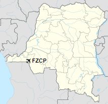
Location of the airport in
Democratic Republic of the Congo
|
| Runways |
| Direction |
Length |
Surface |
| m |
ft |
| 12/30 |
1,140 |
3,740 |
Grass |
|
|
Sources: GCM Google Maps |
The above content comes from Wikipedia and is published under free licenses – click here to read more.
The content above was published at Airports-Worldwide.com in 2019.
We don't guarantee the information is fresh and accurate. The data may be wrong or outdated.
For more up-to-date information please refer to other sources.
|
|


