 |
|
Mutshatsha Airport (ICAO: FZQN) is an airstrip serving the town of Mutshatsha, Katanga Province in Democratic Republic of the Congo. The runway is approximately 10 kilometres (6.2 mi) northwest of the town.
|
Mutshatsha Airport |
|
|
| Summary |
| Airport type |
Public |
| Serves |
Mutshatsha |
| Elevation AMSL |
3,806 ft / 1,160 m |
| Coordinates |
10°33′45″S
24°25′10″E |
| Map |
|
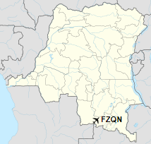
Location of the airport in
Democratic Republic of the Congo
|
| Runways |
| Direction |
Length |
Surface |
| m |
ft |
| 10/28 |
730 |
2,395 |
Grass |
|
|
Sources: HERE Maps GCM |
The above content comes from Wikipedia and is published under free licenses – click here to read more.
The content above was published at Airports-Worldwide.com in 2019.
We don't guarantee the information is fresh and accurate. The data may be wrong or outdated.
For more up-to-date information please refer to other sources.
|
|


