 |
|
Luvua Airport (ICAO: FZRO) is an airstrip atop a mesa overlooking the Luvua River in Katanga Province, Democratic Republic of the Congo.
|
Luvua Airport |
|
|
| Summary |
| Airport type |
Public |
| Serves |
Luvua |
| Elevation AMSL |
4,298 ft / 1,310 m |
| Coordinates |
7°55′50″S
28°31′45″E |
| Map |
|
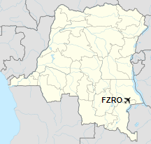
Location of the airport in
Democratic Republic of the Congo
|
| Runways |
| Direction |
Length |
Surface |
| m |
ft |
| 16/34 |
1,900 |
6,234 |
Grass |
|
|
Sources: Google Maps GCM |
The above content comes from Wikipedia and is published under free licenses – click here to read more.
The content above was published at Airports-Worldwide.com in 2019.
We don't guarantee the information is fresh and accurate. The data may be wrong or outdated.
For more up-to-date information please refer to other sources.
|
|


