|
Libenge Airport (IATA: LIE, ICAO: FZFA) is an airport serving the Ubangi River town of Libenge in the Sud-Ubangi
Province of the Democratic Republic of the Congo. The Ubangi is locally the border with the Central African Republic.
The runway has an additional 500 metres (1,600 ft) cleared ground overrun on the southern end.
The Libenge non-directional beacon (Ident: LIB) is located on the airfield.
|
Libenge Airport |
|
|
| Summary |
| Airport type |
Public |
| Serves |
Libenge |
| Elevation AMSL |
1,125 ft / 343 m |
| Coordinates |
3°37′45″N
18°38′15″E |
| Map |
|
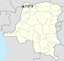
Location of the airport in
Democratic Republic of the Congo
|
| Runways |
| Direction |
Length |
Surface |
| m |
ft |
| 15/33 |
1,580 |
5,184 |
Dirt |
|
|
Sources: Google Maps GCM |
The above content comes from Wikipedia and is published under free licenses – click here to read more.
The content above was published at Airports-Worldwide.com in 2019.
We don't guarantee the information is fresh and accurate. The data may be wrong or outdated.
For more up-to-date information please refer to other sources.
|


