 |
|
Kamituga Airport (ICAO: FZPB) is an airport serving the town of Kamituga in Democratic Republic of the Congo.
The airport is in a shallow valley, with rising terrain in all quadrants.
|
Kamituga Airport |
|
|
| Summary |
| Airport type |
Public |
| Serves |
Kamituga |
| Elevation AMSL |
3,871 ft / 1,180 m |
| Coordinates |
3°02′45″S
28°10′05″E |
| Map |
|
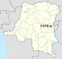
Location of the airport in
Democratic Republic of the Congo
|
| Runways |
| Direction |
Length |
Surface |
| m |
ft |
| 11/29 |
750 |
2,461 |
Gravel |
|
|
Sources: Google Maps GCM |
The above content comes from Wikipedia and is published under free licenses – click here to read more.
The content above was published at Airports-Worldwide.com in 2019.
We don't guarantee the information is fresh and accurate. The data may be wrong or outdated.
For more up-to-date information please refer to other sources.
|
|


