 |
|
Ingende Airport (ICAO: FZEI) is an airstrip serving Ingende, a village on the Ruki River in Équateur Province,
Democratic Republic of the Congo. The runway is 2 kilometres (1.2 mi) west of Ingende.
The Mbandaka VOR/DME (Ident: MBA) is located 40.9 nautical miles (75.7 km) west-southwest of the airstrip.
|
Ingende Airport |
|
|
| Summary |
| Airport type |
Public |
| Serves |
Ingende |
| Elevation AMSL |
1,246 ft / 380 m |
| Coordinates |
0°18′30″S
18°56′45″E |
| Map |
|
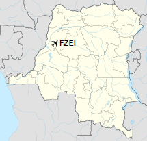
Location of airport in
Democratic Republic of the Congo
|
| Runways |
| Direction |
Length |
Surface |
| m |
ft |
| 03/21 |
1,150 |
3,773 |
Grass |
|
|
Sources: Great Circle Mapper Google Maps |
The above content comes from Wikipedia and is published under free licenses – click here to read more.
The content above was published at Airports-Worldwide.com in 2019.
We don't guarantee the information is fresh and accurate. The data may be wrong or outdated.
For more up-to-date information please refer to other sources.
|
|


