 |
|
Bukena Airport (ICAO: FZRE) is a rural airstrip serving the hamlet of Bukena in Katanga Province, Democratic Republic of the Congo.
The runway is 9 kilometres (5.6 mi) south of Bukena, near the village of Mukwende. It is at the northern edge of the Upemba Depression, 18 kilometres (11 mi) northeast of Lake Kabamba.
|
Bukena Airport |
|
|
| Summary |
| Serves |
Bukena |
| Elevation AMSL |
2,145 ft / 654 m |
| Coordinates |
7°46′40″S
27°12′55″E |
| Map |
|
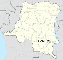
Location of airport in the
Democratic Republic of the Congo
|
| Runways |
| Direction |
Length |
Surface |
| m |
ft |
| 07/25 |
1,275 |
4,183 |
Grass |
|
|
Source: GCM Google Maps |
The above content comes from Wikipedia and is published under free licenses – click here to read more.
The content above was published at Airports-Worldwide.com in 2019.
We don't guarantee the information is fresh and accurate. The data may be wrong or outdated.
For more up-to-date information please refer to other sources.
|
|


