|
Herkale Airport (ICAO: HDHE) is an airstrip 7 kilometres (4 mi) northwest of the hamlet
of Khôr ‘Angar in Djibouti. Khôr ‘Angar is by the Bab-el-Mandeb strait, the entrance to the Red Sea.
The Assab non-directional beacon (Ident: SB) is located 53.2 nautical miles (99 km) northwest of the
airstrip. The Djibouti VOR-DME (Ident: DTI) is located 55.1 nautical miles (102 km) south-southwest
of the airstrip.
Google Earth Historical Imagery (10/14/2001) shows a well-marked runway. The markings are deteriorating in the (10/25/2010) image, and gone by (5/19/2016).
|
Herkale Airport |
|
|
| Summary |
| Airport type |
Public |
| Operator |
Directorate of Civil Aviation and Meteorology |
| Serves |
Khôr ‘Angar, Djibouti |
| Elevation AMSL |
38 ft / 12 m |
| Coordinates |
12°26′30″N
43°17′30″E |
| Map |
|
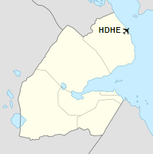
Location of the airport in Djibouti
|
| Runways |
| Direction |
Length |
Surface |
| m |
ft |
| 01/19 |
1,485 |
4,872 |
Dirt |
|
|
Source: Google Maps GCM |
The above content comes from Wikipedia and is published under free licenses – click here to read more.
The content above was published at Airports-Worldwide.com in 2020.
We don't guarantee the information is fresh and accurate. The data may be wrong or outdated.
For more up-to-date information please refer to other sources.
|


