 |
|
|
|
 |
|
Airport classification:
4E (cat. 7)
Runway specifications:
RWY 28L/10R: 3000m/4E
RWY 28R/10L: 3000m/4B
ILS RWY 28L: CAT IIIB
ILS RWY 10R: CAT I
Apron specifications:
Piers: 4
Remote: 3
Opening Hours:
06.00 a.m. - 12.00 p.m.
Airlines Serving Airport: British Airways, First Choice, Maersk Air (UK), North Flying, Ryanair, SAS-Scandinavian, Sun Air, Westair
Cargo Facilities: Capacity 25,000tonnes (55,115,000lbs), Warehouse 1,000m? (10,763sq ft), Bonded Warehouse, Transit Zone, EU Border Post, Heated Storage, Refrigerated Storage, Deep Freeze Storage, Health Officials, X-Ray Equipment, Dangerous Goods, Very Large/Heavy Cargo, Express/Courier Centre, Handling Equipment: High loaders, Forklifts
Customs Hours: 06.00-24.00
Passenger Facilities: Annual Capacity 2,000,000, 10 check-in desks, 4 gates, 2 airbridges, 1,500 long term parking spaces, Min. Connection Times Intl-Intl: 25mins, Dom-Intl: 15mins, Dom-Dom: 25mins, Restaurants, Cafeterias, Bars, VIP Lounge, Duty Free Shop, Newsagent/Tobacconist, Gift Shop, Travel Agent, Tourist Help Desk, Car Rental, Taxi Service/Rank, First Aid, Baby/Parent Room, Disabled Access/Facilities
Aarhus Airport Ltd.
Stabrandvej 24
8560 Kolind
Denmark
Tel. 0045 87 75 70 00
Fax: +45 87 75 70 30
Telex: 60718
SITA: AARAPXH
E-mail: info at aar dk
WWW: Aarhus Airport
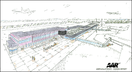
Images and information placed above are from
http://www.azworldairports.com/
We thank them for the data!
| General Info
|
| Country |
Denmark
|
| ICAO ID |
EKAH
|
| Time |
UTC+1(+2DT)
|
| Latitude |
56.300017
56° 18' 00.06" N
|
| Longitude |
10.619008
010° 37' 08.43" E
|
| Elevation |
82 feet
25 meters
|
| Type |
Civil
|
| Magnetic Variation |
001° E (01/05)
|
| Operating Agency |
CIVIL GOVERNMENT, (LANDING FEES AND DIPLOMATIC CLEARANCE MAY BE REQUIRED)
|
| Operating Hours |
SEE REMARKS FOR OPERATING HOURS OR COMMUNICATIONS FOR POSSIBLE HOURS
|
| Daylight Savings Time |
Last Sunday in March to last Sunday in October
|
| Communications
|
| TWR |
118.525
|
| HANDLING |
130.225
|
| APP |
119.275
|
| Runways
|
ID
|
Dimensions |
Surface |
PCN |
ILS
|
| 10R/28L |
8865 x 148 feet
2702 x 45 meters |
PART CONCRETE, PART ASPHALT, OR PART BITUMEN-BOUND MACADAM. |
076RBXU |
YES
|
| 10L/28R |
9111 x 75 feet
2777 x 23 meters |
PART CONCRETE, PART ASPHALT, OR PART BITUMEN-BOUND MACADAM. |
120FBWT |
NO
|
| Navaids
|
| Type |
ID |
Name |
Channel |
Freq |
Distance From Field |
Bearing From Navaid
|
| NDB |
TU |
AARHUS |
- |
374 |
5.3 NM |
277.1
|
| Supplies/Equipment
|
| Fuel |
Jet A1, without icing nhibitor.
100/130 MIL Spec, low lead, aviation gasoline (BLUE)
|
| Other Fluids |
DE-ICE, Anti-icing/De-icing/Defrosting Fluid (MIL A 8243)
|
| Remarks
|
| CAUTION |
Possible turb on Rwy 28 final with S and SW wind aprx 10 Kt.
|
| FLUID |
De-Ice O/R, ctc Airport Office 130.225.
|
| FUEL |
(NC 100LL, A1) 100LL self-svc only.
|
| LGT |
PAPI Rwy 10R-28L GS 2.75 .
|
| MISC |
Ldg fees.
|
| OPR HOURS |
Opr 0500-2100Z++, OT PPR.
|
Runway 10R/28L
8865 x 148 feet
2702 x 45 meters
| Runway 10R
|
| Surface |
PART CONCRETE, PART ASPHALT, OR PART BITUMEN-BOUND MACADAM.
|
| True Heading |
100.0
|
| Latitude |
56.305492
56° 18' 19.77" N
|
| Longitude |
10.597567
010° 35' 51.24" E
|
| Elevation |
81.0 feet
25 meters
|
| Slope |
-0.1°
|
| Landing Distance |
8865 feet
2702 meters
|
| Takeoff Distance |
9603 feet
2927 meters
|
| Overrun Length |
738 feet
225 meters
|
| Overrun Surface |
ASPHALT
|
| Lighting System |
CL
HIRL
BP
PAPI |
| Runway 28L
|
| Surface |
PART CONCRETE, PART ASPHALT, OR PART BITUMEN-BOUND MACADAM.
|
| True Heading |
280.0
|
| Latitude |
56.301158
56° 18' 04.17" N
|
| Longitude |
10.640511
010° 38' 25.84" E
|
| Elevation |
75.0 feet
23 meters
|
| Slope |
0.1°
|
| Landing Distance |
8865 feet
2702 meters
|
| Takeoff Distance |
9767 feet
2977 meters
|
| Overrun Length |
902 feet
275 meters
|
| Overrun Surface |
ASPHALT
|
| Lighting System |
TDZL
CL
HIRL
J
PAPI |
Runway 10L/28R
9111 x 75 feet
2777 x 23 meters
| Runway 10L
|
| Surface |
PART CONCRETE, PART ASPHALT, OR PART BITUMEN-BOUND MACADAM.
|
| True Heading |
100.0
|
| Latitude |
56.307433
56° 18' 26.76" N
|
| Longitude |
10.597797
010° 35' 52.07" E
|
| Elevation |
79.0 feet
24 meters
|
| Slope |
0.0°
|
| Landing Distance |
9111 feet
2777 meters
|
| Takeoff Distance |
9111 feet
2777 meters
|
| Lighting System |
LIRL
|
| Runway 28R
|
| Surface |
PART CONCRETE, PART ASPHALT, OR PART BITUMEN-BOUND MACADAM.
|
| True Heading |
280.0
|
| Latitude |
56.302975
56° 18' 10.71" N
|
| Longitude |
10.641931
010° 38' 30.95" E
|
| Elevation |
78.0 feet
24 meters
|
| Slope |
0.0°
|
| Landing Distance |
9111 feet
2777 meters
|
| Takeoff Distance |
9111 feet
2777 meters
|
| Lighting System |
LIRL
|
Navaids
| AARHUS
|
| Type |
ID |
Channel |
Freq |
Country |
State
|
| NDB |
TU |
- |
374 |
Denmark |
-
|
| Latitude |
Longitude |
Airport
|
56.287953
56° 17' 16.63" N |
10.775275
010° 46' 30.99" E |
EKAH |
The content above was published at Airports-Worldwide.com in 2005.
We don't guarantee the information is fresh and accurate. The data may be wrong or outdated.
For more up-to-date information please refer to other sources.
|
|


