|
|
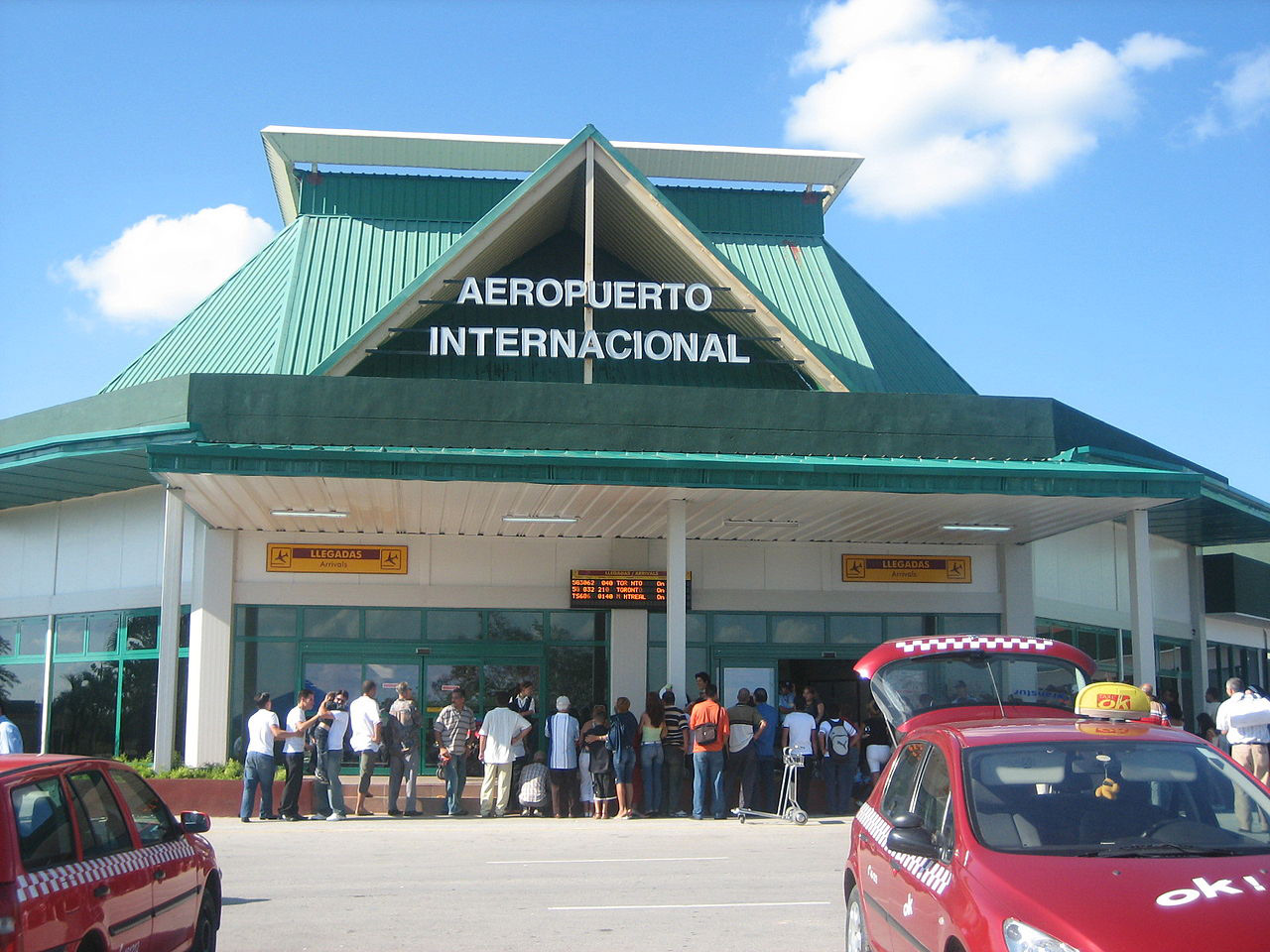
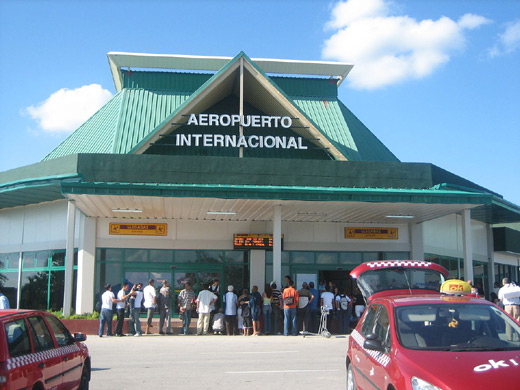
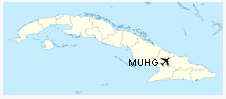
| Frank País International Airport |
 |
IATA: HOG – ICAO: MUHG
 |
| Summary |
| Airport type |
Public |
| Operator |
ECASA (Empresa Cubana de Aeropuertos y Servicios Aeronáuticos S.A.) |
| Serves |
Holguín |
| Location |
municipio of Holguin |
| Elevation AMSL |
361 ft / 110 m |
| Coordinates |
20°47′08″N 76°18′54″W / 20.78556°N 76.315°W / 20.78556; -76.315Coordinates: 20°47′08″N 76°18′54″W / 20.78556°N 76.315°W / 20.78556; -76.315 |
| Website |
www.airportcuba.com |
| Runways |
| Direction |
Length |
Surface |
| ft |
m |
| 05/23 |
10,624 |
3,238 |
Asphalt |
Frank País Airport (IATA: HOG, ICAO: MUHG) is an international airport that serves the city of Holguín in Cuba. It bears the name of Cuban revolutionary Frank País and is located in the municipio of Frank País. Airlines and destinations
| Airlines |
Destinations |
| Aerocaribbean |
Havana, Santiago de Cuba |
| Air Canada |
Halifax, Montréal-Trudeau, Toronto-Pearson |
| Air Transat |
Halifax, Montréal-Trudeau, Toronto-Pearson |
| Blue Panorama Airlines |
Milan-Malpensa |
| CanJet |
Halifax, Montreal, Ottawa, Quebec City, St. John's, Toronto-Pearson,Hamilton, |
| Condor |
Frankfurt |
| Cubana de Aviación |
Havana, London-Gatwick, Montréal-Trudeau, Toronto-Pearson |
| Edelweiss Air |
Zürich |
| Livingston Energy Flight |
Milan-Malpensa |
| Martinair |
Amsterdam |
| Neos |
Milan-Malpensa |
| Sunwing Airlines |
Bagotville, Montréal-Trudeau, Quebec City, Toronto-Pearson |
| Thomas Cook Airlines |
London-Gatwick, Manchester |
| Thomson Airways |
London-Gatwick, Manchester [seasonal] |
| WestJet |
Toronto-Pearson [seasonal] |
The above content comes from Wikipedia and is published under free licenses – click here to read more.
| General Info
|
| Country |
Cuba
|
| ICAO ID |
MUHG
|
| Time |
UTC-5(-4DT)
|
| Latitude |
20.785589
20° 47' 08.12" N
|
| Longitude |
-76.315108
076° 18' 54.39" W
|
| Elevation |
361 feet
110 meters
|
| Type |
Joint (Civil and Military)
|
| Magnetic Variation |
007° W (01/06)
|
| Beacon |
Yes
|
| Operating Agency |
MILITARY - CIVIL JOINT USE AIRPORT
|
| Near City |
Holguin
|
| Operating Hours |
SEE REMARKS FOR OPERATING HOURS OR COMMUNICATIONS FOR POSSIBLE HOURS
|
| Daylight Saving Time |
Last Sunday in March to last Sunday in October
|
| Communications
|
| HOLGUIN TWR |
118.0
|
| HOLGUIN APP |
119.1
|
| HOLGUIN RDO |
126.9
3407
5562
6673
8876
|
| Runways
|
| ID |
Dimensions |
Surface |
PCN |
ILS
|
| 05/23 |
10624 x 148 feet
3238 x 45 meters |
ASPHALT |
057FBXU |
YES
|
| Navaids
|
| Type |
ID |
Name |
Channel |
Freq |
Distance From Field |
Bearing From Navaid
|
| VOR-DME |
UHG |
HOLGUIN |
115X |
116.8 |
At Field |
-
|
| NDB |
UHG |
HOLGUIN |
- |
353 |
4.8 NM |
053.2
|
| Supplies/Equipment
|
| Fuel |
Jet A1, without icing nhibitor.
Aviation Gasoline (AVGAS), octane unknown.
|
| Remarks
|
| CAUTION |
Mil jet opr. Bird haz.
|
| CSTMS/IMG |
1200-0400Z++ OT 24 hr PN
|
| FUEL |
Opr 1200-0400Z OT O/R 24HR PN. (NC-A1)
|
| RSTD |
Acft rstd to turning around at rwy ends. Twy A and C unsvc to acft heavier than 24 tons. Twy B ltd to Mil acft.
|
The content above was published at Airports-Worldwide.com in 2010.
We don't guarantee the information is fresh and accurate. The data may be wrong or outdated.
For more up-to-date information please refer to other sources.
|
|