|
|
Owando Airport (IATA: FTX, ICAO: FCOO) is an airport serving the town of Owando, the capital of the Cuvette Department in the Republic of the Congo.
The airport is 4 kilometres (2.5 mi) southeast of the town. The disused Runway 09/27 abuts the southeast end of the new runway.
|
Owando Airport
|
|
|
| Summary |
| Airport type |
Public / Military |
| Location |
Owando, Republic of the Congo |
| Elevation AMSL |
1,214 ft / 370 m |
| Coordinates |
0°31′20″S
15°56′10″E |
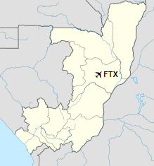
| Map |
Location in Republic of the Congo
|
| Runways |
| Direction |
Length |
Surface |
| m |
ft |
| 14/32 |
2,050 |
6,726 |
Asphalt |
|
The above content comes from Wikipedia and is published under free licenses – click here to read more.
| General Info
|
| Country |
Congo
|
| ICAO ID |
FCOO
|
| Time |
UTC+1
|
| Latitude |
-0.531350
00° 31' 52.86" S
|
| Longitude |
15.950094
015° 57' 00.34" E
|
| Elevation |
1214 feet
370 meters
|
| Magnetic Variation |
002° W (01/06)
|
| Operating Agency |
MILITARY - CIVIL JOINT USE AIRPORT
|
| Runways
|
| ID |
Dimensions |
Surface |
PCN |
ILS
|
| 09/27 |
5905 x 98 feet
1800 x 30 meters |
ASPHALT |
- |
NO
|
The content above was published at Airports-Worldwide.com in 2019.
We don't guarantee the information is fresh and accurate. The data may be wrong or outdated.
For more up-to-date information please refer to other sources.
|
|