 |
|
Hohhot Baita International Airport
呼和浩特白塔国际机场 |
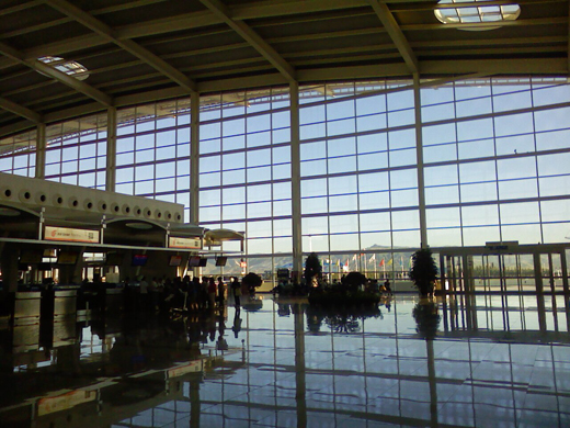 |
| Airport interior, 2008 |
| IATA: HET – ICAO: ZBHH |
| Summary |
| Airport type |
Public |
| Operator |
Civil Aviation Administration of China |
| Serves |
Hohhot |
| Elevation AMSL |
3,556 ft / 1,084 m |
| Coordinates |
40°51′05.12″N 111°49′26.77″E / 40.8514222°N 111.8241028°E / 40.8514222; 111.8241028 |
| Runways |
| Direction |
Length |
Surface |
| ft |
m |
08/26 (Closed) |
10,501 |
3,201 |
Concrete |
| 08R/26L |
11,811 |
3,600 |
Concrete |
Hohhot Baita International Airport (simplified Chinese: 呼和浩特白塔国际机场) is an airport in Hohhot, Inner Mongolia, China (IATA: HET, ICAO: ZBHH). It is the largest airport in Inner Mongolia and lies 14.3 km (8.9 miles) east of downtown Hohhot. Its name Baita meaning White Pagoda derives from Wanbu Huayanjing Pagoda, one of the historical attractions in Hohhot which lies 5.6 km (3.5 miles) south-east of the airport. History and expansion
Hohhot Baita airport was opened on October 1, 1958. In the mid 1980s and 1990s, it underwent two expansions and in June 2007 a new terminal was constructed. The new terminal covers an area of 54499m² with 11 parking jetways and is capable of handling 3 million passengers each year. Furthermore, its runway has also been lengthened and its width increased so that it can accommodate the take off and landing of jumbo jets such as the Airbus A380. It served as one of the diversion airports for air traffic during the 2008 Summer Olympics.
Presently Hohhot airport is connected to 28 domestic cities by 26 air routes, it serves international scheduled flights to Ulan Bator as well as charter flights to Hong Kong, Russia and Thailand.
Airlines and destinations
| Airlines |
Destinations |
| Aero Mongolia |
Ulan Bator |
| Air China |
Beijing-Capital, Guangzhou, Shanghai-Hongqiao |
| China Eastern Airlines |
Nanjing, Shanghai-Hongqiao, Shijiazhuang, Xi'an |
| China Southern Airlines |
Hong Kong, Kunming, Ningbo, Shenyang, Urumqi, Zhengzhou |
| China United Airlines |
Beijing-Nanyuan |
| Hainan Airlines |
Beijing-Capital, Haikou, Shenzhen, Wuhai |
| Juneyao Airlines |
Shanghai-Hongqiao |
| Shandong Airlines |
Chifeng, Hailar, Harbin, Jinan, Manzhouli, Qingdao, Tianjin, Tongliao, Ulanhot, Xiamen, Xilinhot |
| Shanghai Airlines |
Shanghai-Hongqiao |
| Shenzhen Airlines |
Baotou, Guangzhou, Shenzhen, Wuhan |
| Tianjin Airlines |
Chifeng, Dalian, Lanzhou, Shenyang, Ulan Bator [begins 19 October], Ulanhot, Xi'an |
The above content comes from Wikipedia and is published under free licenses – click here to read more.
| General Info
|
| Country |
China
|
| ICAO ID |
ZBHH
|
| Time |
UTC+8
|
| Latitude |
40.851422
40° 51' 05.12" N
|
| Longitude |
111.824103
111° 49' 26.77" E
|
| Elevation |
3556 feet
1084 meters
|
| Type |
Civil
|
| Magnetic Variation |
005° W (01/06)
|
| Operating Agency |
CIVIL GOVERNMENT, (LANDING FEES AND DIPLOMATIC CLEARANCE MAY BE REQUIRED)
|
| Alternate Name |
HOHHOT
|
| Near City |
Hohhot
|
| Operating Hours |
SEE REMARKS FOR OPERATING HOURS OR COMMUNICATIONS FOR POSSIBLE HOURS
|
| Communications
|
| HOHHOT TWR |
118.1
|
HOHHOT GND
Opr HO.
|
121.65
|
| Runways
|
| ID |
Dimensions |
Surface |
PCN |
ILS
|
08/26
CLOSED |
10501 x 148 feet
3201 x 45 meters |
CONCRETE. |
039RBWT |
YES
|
| 08R/26L |
11811 x 148 feet
3600 x 45 meters |
CONCRETE. |
074RBWT |
NO
|
| Navaids
|
| Type |
ID |
Name |
Channel |
Freq |
Distance From Field |
Bearing From Navaid
|
| NDB |
KJ |
HOHHOT |
- |
434 |
3.1 NM |
249.2
|
| Remarks
|
| CSTMS/AG/IMG |
Avbl.
|
| FUEL |
(NC-100LL, J)
|
| OPR HOURS |
Opr HS or O/R.
|
The content above was published at Airports-Worldwide.com in 2010.
We don't guarantee the information is fresh and accurate. The data may be wrong or outdated.
For more up-to-date information please refer to other sources.
|
|


