 |
|
Vicuña Airport Spanish: Aeropuerto de Vicuña or El Indio Airport, (ICAO: SCVC)
is an extremely high elevation airstrip 66 kilometres (41 mi) east-northeast of Vicuña, Coquimbo, Chile.
The airstrip serves several small settlements, and is subject to snow cover. It is within a small fold above a steep mountain
valley high in the Andes, and runs uphill to the north. There is mountainous terrain in all quadrants, with a best escape route to the south down the valley.
|
Vicuña Airport
El Indio Airport |
|
|
| Summary |
| Airport type |
Public |
| Elevation AMSL |
11,975 ft / 3,650 m |
| Coordinates |
29°50′00″S
70°02′46″W |
| Map |
|
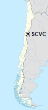
Location of Vicuña Airport in Chile
|
| Runways |
| Direction |
Length |
Surface |
| m |
ft |
| 02/20 |
1,090 |
3,576 |
Grass |
|
|
Source: Landings.com Google Maps GCM |
The above content comes from Wikipedia and is published under free licenses – click here to read more.
The content above was published at Airports-Worldwide.com in 2020.
We don't guarantee the information is fresh and accurate. The data may be wrong or outdated.
For more up-to-date information please refer to other sources.
|
|


