Ventanas Radioayuda Airport |
Viña Tarapacá Airport Spanish: Aeropuerto Viña Tarapacá, (ICAO: SCVT)
is an airport located 3 kilometres (2 mi) southwest of Isla de Maipo, a town in the Santiago Metropolitan Region of Chile.
The runway lies along the Maipo River. There is distant rising terrain west of the airport.
The Talagante non-directional beacon (Ident: TAL) is located 5.1 nautical miles (9.4 km) north of the airport.
The Los Cerrillos VOR-DME (Ident: STI) is located 19.3 nautical miles (35.7 km) northeast of the airport.
|
Viña Tarapacá Airport
Ventanas Radioayuda Airport |
|
|
| Summary |
| Airport type |
Public |
| Serves |
Isla de Maipo, Chile |
| Elevation AMSL |
1,066 ft / 325 m |
| Coordinates |
33°46′01″S
70°55′20″W |
| Map |
|
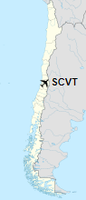
Location of Viña Tarapacá Airport in Chile
|
| Runways |
| Direction |
Length |
Surface |
| m |
ft |
| 09/27 |
670 |
2,198 |
Asphalt |
|
|
Source: Landings.com Google Maps GCM |
The above content comes from Wikipedia and is published under free licenses – click here to read more.
The content above was published at Airports-Worldwide.com in 2020.
We don't guarantee the information is fresh and accurate. The data may be wrong or outdated.
For more up-to-date information please refer to other sources.
|


