|
|
Teniente Vidal Airport Spanish: Aeródromo Teniente Vidal, (IATA: GXQ, ICAO: SCCY) is an airport serving Coyhaique, capital of the Aysén Region of Chile. The airport is 3 kilometres (1.9 mi) southwest of Coyhaique.
The runway has an additional 260 metres (850 ft) of unpaved overrun on the northeast end. There is a mountain nearby to the southeast, and rising terrain nearby northwest.
The Balmaceda VOR-DME (Ident: BAL) is located 25.3 nautical miles (46.9 km) southeast of the airport.
|
Teniente Vidal Airport
|
|
|
| Summary |
| Airport type |
Public |
| Serves |
Coyhaique, Chile |
| Elevation AMSL |
1,020 ft / 311 m |
| Coordinates |
45°35′40″S
72°06′24″W |
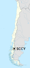
| Map |
Location of Teniente Vidal Airport in Chile
|
| Runways |
| Direction |
Length |
Surface |
| m |
ft |
| 03/21 |
1,548 |
5,079 |
Asphalt |
|
The above content comes from Wikipedia and is published under free licenses – click here to read more.
| General Info
|
| Country |
Chile
|
| ICAO ID |
SCCY
|
| Time |
UTC-4(-3DT)
|
| Latitude |
-45.594211
45° 35' 39.16" S
|
| Longitude |
-72.106133
072° 06' 22.08" W
|
| Elevation |
1020 feet
311 meters
|
| Magnetic Variation |
011° E (01/06)
|
| Operating Agency |
CIVIL GOVERNMENT, (LANDING FEES AND DIPLOMATIC CLEARANCE MAY BE REQUIRED)
|
| Near City |
Coyhaique
|
| Operating Hours |
SUNRISE TO SUNSET (SR-SS)
|
| Communications
|
COYHAIQUE RDO
Opr 1230Z++-SS, OT O/R.
|
5454
|
| COYHAIQUE GND |
5454
|
AFIS
Opr 1230Z++-SS, OT O/R.
|
126.7
|
| Runways
|
| ID |
Dimensions |
Surface |
PCN |
ILS
|
| 03/21 |
5072 x 98 feet
1546 x 30 meters |
ASPHALT |
030FBXT |
NO
|
| Remarks
|
| MISC |
First 807 ft of Rwy 21 is concrete.
|
| OPR HOURS |
Opr SR-SS.
|
The content above was published at Airports-Worldwide.com in 2020.
We don't guarantee the information is fresh and accurate. The data may be wrong or outdated.
For more up-to-date information please refer to other sources.
|
|