Santa Teresa del Almendral Airport |
Santa Teresa del Almendral Airport (Spanish: Aeropuerto de Santa Teresa del Almendral), (ICAO:
SCTS) is an airport 12 kilometres (7.5 mi) north-northwest of Melipilla, a city in the Santiago Metropolitan
Region of Chile. The airport is 1 kilometre (0.6 mi) west of the Puangue River.
There is distant rising terrain west and north. Runway 27 has an additional 235 metres (771 ft) of unpaved overrun.
|
Santa Teresa del Almendral Airport |
|
|
| Summary |
| Airport type |
Private |
| Serves |
Melipilla, Chile |
| Elevation AMSL |
574 ft / 175 m |
| Coordinates |
33°34′28″S
71°15′45″W |
| Map |
|
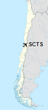
Location of Santa Teresa del Almendral Airport in Chile
|
| Runways |
| Direction |
Length |
Surface |
| m |
ft |
| 01/19 |
770 |
2,526 |
Grass |
| 09/27 |
770 |
2,526 |
Grass |
|
|
Source: Landings.com Google Maps GCM |
The above content comes from Wikipedia and is published under free licenses – click here to read more.
The content above was published at Airports-Worldwide.com in 2020.
We don't guarantee the information is fresh and accurate. The data may be wrong or outdated.
For more up-to-date information please refer to other sources.
|


