Santa Rosa De Tabali Airport |
Santa Rosa de Tabalí Airport (Spanish: Aeropuerto Santa Rosa de Tabalí, (ICAO: SCOT)) is an airport serving Santa Rosa de Tabalí, a hacienda winery in the Coquimbo Region of Chile.
The airport is 20 kilometres (12 mi) west-southwest of Ovalle. The west end of the runway has a 180 metres (590 ft) paved overrun that leads to a helipad and parking apron. The local terrain is flat with ravines.
|
Santa Rosa de Tabalí Airport
Aeropuerto Santa Rosa de Tabalí
|
|
|
| Summary |
| Airport type |
Private |
| Serves |
Santa Rosa de Tabalí, Chile |
| Elevation AMSL |
787 ft / 240 m |
| Coordinates |
30°40′35″S
71°24′03″W |
| Map |
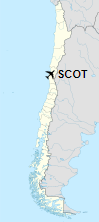
Location of Santa Rosa de Tabalí Airport in Chile
|
| Runways |
| Direction |
Length |
Surface |
| m |
ft |
| 07/25 |
1,300 |
4,265 |
Asphalt |
|
| Helipads |
| Number |
Length |
Surface |
| m |
ft |
| 1 |
35 |
115 |
Concrete |
|
The above content comes from Wikipedia and is published under free licenses – click here to read more.
| General Info
|
| Country |
Chile
|
| ICAO ID |
SCOT
|
| Time |
UTC-4(-3DT)
|
| Latitude |
-30.676525
30° 40' 35.49" S
|
| Longitude |
-71.400967
071° 24' 03.48" W
|
| Elevation |
787 feet
240 meters
|
| Magnetic Variation |
002° E (01/06)
|
| Operating Agency |
CIVIL GOVERNMENT, (LANDING FEES AND DIPLOMATIC CLEARANCE MAY BE REQUIRED)
|
| Operating Hours |
SUNRISE TO SUNSET (SR-SS)
|
| Runways
|
| ID |
Dimensions |
Surface |
PCN |
ILS
|
| 07/25 |
3084 x 39 feet
940 x 12 meters |
ASPHALT |
- |
NO
|
| Remarks
|
| CAUTION |
Mrk pwr lines and tall trees thld Rwy 07.
|
| OPR HOURS |
Opr SR-SS.
|
The content above was published at Airports-Worldwide.com in 2020.
We don't guarantee the information is fresh and accurate. The data may be wrong or outdated.
For more up-to-date information please refer to other sources.
|