|
Santa Rita Airport (ICAO: SCCS) is an airstrip 6 kilometres (3.7 mi) northwest of Casablanca, a city in the Valparaíso Region of Chile.
There is rising terrain north and west of the runway.
The Santo Domingo VOR-DME (Ident: SNO) is located 24.7 nautical miles (45.7 km) south-southwest of the airstrip.
|
Santa Rita Airport |
|
|
| Summary |
| Airport type |
Public |
| Serves |
Casablanca, Chile |
| Elevation AMSL |
738 ft / 225 m |
| Coordinates |
33°16′35″S
71°27′20″W |
| Map |
|
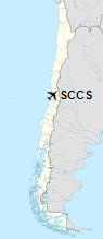
Location of Santa Rita Airport in Chile
|
| Runways |
| Direction |
Length |
Surface |
| m |
ft |
| 03/21 |
700 |
2,297 |
Grass |
|
|
Source: SkyVector Google Maps |
The above content comes from Wikipedia and is published under free licenses – click here to read more.
The content above was published at Airports-Worldwide.com in 2020.
We don't guarantee the information is fresh and accurate. The data may be wrong or outdated.
For more up-to-date information please refer to other sources.
|


