 |
|
Santa Bárbara Airport (Spanish: Aeropuerto de Santa Bárbara, (ICAO: SCRO)) is an airport 8
kilometres (5.0 mi) east of Romeral, a town in the Maule Region of Chile.
The Curico VOR-DME (Ident: ICO) is located 9.0 nautical miles (16.7 km) west of the airport, on the General Freire Airfield.
|
Santa Bárbara Airport |
|
|
| Summary |
| Airport type |
Private |
| Serves |
Romeral, Chile |
| Elevation AMSL |
1,420 ft / 433 m |
| Coordinates |
34°57′32″S
71°01′55″W |
| Map |
|
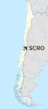
Location of Santa Bárbara Airport in Chile
|
| Runways |
| Direction |
Length |
Surface |
| m |
ft |
| 09/27 |
605 |
1,985 |
Gravel |
|
|
Source: Google Maps GCM |
The above content comes from Wikipedia and is published under free licenses – click here to read more.
The content above was published at Airports-Worldwide.com in 2020.
We don't guarantee the information is fresh and accurate. The data may be wrong or outdated.
For more up-to-date information please refer to other sources.
|
|


