|
Río Pascua Airport (Spanish: Aeropuerto Río Pascua), (ICAO: SCTP) is an airport
serving small settlements along the Pascua River in the Aysén Region of Chile. The runway is 51 kilometres (32 mi) south-southwest of Caleta Tortel, a coastal village.
There is mountainous terrain in all quadrants. The runway is aligned northwest with the lowest terrain routing.
|
Río Pascua Airport |
|
|
| Summary |
| Airport type |
Public |
| Serves |
Caleta Tortel, Chile |
| Elevation AMSL |
197 ft / 60 m |
| Coordinates |
48°13′43″S
73°18′00″W |
| Map |
|
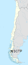
Location of Río Pascua Airport in Chile
|
| Runways |
| Direction |
Length |
Surface |
| m |
ft |
| 12/30 |
700 |
2,297 |
Grass |
|
|
Source: Landings.com GCM |
The above content comes from Wikipedia and is published under free licenses – click here to read more.
The content above was published at Airports-Worldwide.com in 2020.
We don't guarantee the information is fresh and accurate. The data may be wrong or outdated.
For more up-to-date information please refer to other sources.
|


