|
Río Bravo Airport (Spanish: Aeropuerto Río Bravo, (ICAO: SCRB)) is an airstrip
36 kilometres (22 mi) southeast of Caleta Tortel in the Aysén Region of Chile. The airstrip serves settlements
along the Estero Mitchell, one of the many channels leading to the Pacific Ocean.
There is mountainous terrain in all quadrants.
|
Río Bravo Airport |
|
|
| Summary |
| Airport type |
Public |
| Serves |
Caleta Tortel, Chile |
| Location |
Rio Bravo |
| Elevation AMSL |
37 ft / 11 m |
| Coordinates |
47°59′25″S
73°08′33″W |
| Map |
|
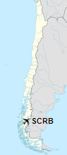
Location of Río Bravo Airport in Chile
|
| Runways |
| Direction |
Length |
Surface |
| m |
ft |
| 10/28 |
710 |
2,329 |
Grass |
|
|
Sources: Landings.com Google Maps GCM |
The above content comes from Wikipedia and is published under free licenses – click here to read more.
The content above was published at Airports-Worldwide.com in 2020.
We don't guarantee the information is fresh and accurate. The data may be wrong or outdated.
For more up-to-date information please refer to other sources.
|


