|
Piedra Negra Airport (Spanish: Aeropuerto Piedra Negra), (ICAO: SCKE) is
an airstrip just southwest of Curanipe, a Pacific coastal town 6 kilometres (4 mi) southwest of Pelluhue, in the Maule Region of Chile.
The airstrip is in a wooded section less than 1 kilometre (0.6 mi) inland from the shore. The runway has a rising slope to the northeast.
|
Piedra Negra Airport |
|
|
| Summary |
| Airport type |
Public |
| Serves |
Pelluhue, Chile |
| Location |
Curanipe |
| Elevation AMSL |
164 ft / 50 m |
| Coordinates |
35°51′15″S
72°38′45″W |
| Map |
|
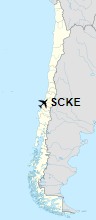
Location of Piedra Negra Airport in Chile
|
| Runways |
| Direction |
Length |
Surface |
| m |
ft |
| 04/22 |
635 |
2,083 |
Grass |
|
|
Source: Landings.com Google Maps GCM |
The above content comes from Wikipedia and is published under free licenses – click here to read more.
The content above was published at Airports-Worldwide.com in 2020.
We don't guarantee the information is fresh and accurate. The data may be wrong or outdated.
For more up-to-date information please refer to other sources.
|


