|
|
Pelicano Airport Spanish: Aeropuerto Pelicano, (ICAO: SCEC) is a desert airport near Estación Chañar (es), in the Coquimbo Region of Chile.
The airport serves the astronomy community of the Las Campanas Observatory, one of the high elevation observatories in the Atacama Desert.
The runway has an additional 360 metres (1,180 ft) of gravel overrun on the south end, which then drops into a canyon.
|
Pelicano Airport
|
|
|
| Summary |
| Airport type |
Public |
| Serves |
Estación Chañar (es), Chile |
| Elevation AMSL |
3,678 ft / 1,121 m |
| Coordinates |
29°08′40″S
70°53′16″W |
| Map |
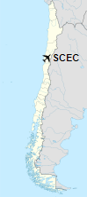
Location of Pelicano Airport in Chile
|
| Runways |
| Direction |
Length |
Surface |
| m |
ft |
| 02/20 |
1,320 |
4,331 |
Asphalt |
|
The above content comes from Wikipedia and is published under free licenses – click here to read more.
| General Info
|
| Country |
Chile
|
| ICAO ID |
SCEC
|
| Time |
UTC-4(-3DT)
|
| Latitude |
-29.144886
29° 08' 41.59" S
|
| Longitude |
-70.887772
070° 53' 15.98" W
|
| Elevation |
3678 feet
1121 meters
|
| Magnetic Variation |
001° E (01/06)
|
| Operating Agency |
PRIVATE
|
| Near City |
Estacion Chanar
|
| Operating Hours |
SUNRISE TO SUNSET (SR-SS)
|
| Runways
|
| ID |
Dimensions |
Surface |
PCN |
ILS
|
| 02/20 |
4199 x 100 feet
1280 x 30 meters |
ASPHALT |
- |
NO
|
| Remarks
|
| OPR HOURS |
Opr SR-SS.
|
The content above was published at Airports-Worldwide.com in 2020.
We don't guarantee the information is fresh and accurate. The data may be wrong or outdated.
For more up-to-date information please refer to other sources.
|
|