|
Los Lirios Airport Spanish: Aeropuerto Los Lirios, (ICAO: SCKI)
is a rural airport 8 kilometres (5 mi) north of Curicó, a city in the Maule Region of Chile. The airport is 1.6 kilometres (1 mi) from the Teno River.
The runway has 130 metres (430 ft) of unpaved overrun on the north end.
The Curico VOR-DME (Ident: ICO) is 3.9 nautical miles (7.2 km) south of the airport.
|
Los Lirios Airport |
|
|
| Summary |
| Airport type |
Private |
| Serves |
Curicó, Chile |
| Elevation AMSL |
820 ft / 250 m |
| Coordinates |
34°54′25″S
71°12′10″W |
| Map |
|
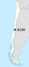
Location of Los Lirios Airport in Chile
|
| Runways |
| Direction |
Length |
Surface |
| m |
ft |
| 03/21 |
600 |
1,969 |
Grass |
|
|
Source: Landings.com Google Maps GCM |
The above content comes from Wikipedia and is published under free licenses – click here to read more.
The content above was published at Airports-Worldwide.com in 2020.
We don't guarantee the information is fresh and accurate. The data may be wrong or outdated.
For more up-to-date information please refer to other sources.
|


