|
Los Alerces Airport (ICAO: SCLR) is an airstrip 16 kilometres (9.9 mi) north-northeast of Chaitén, a
coastal city in the Los Lagos Region of Chile. The airstrip is in an open mountain valley 6 kilometres (3.7 mi) north of the Chaitén volcano caldera.
The Chaiten VOR-DME (Ident: TEN) is 8.4 nautical miles (15.6 km) west of the airstrip.
There is mountainous terrain in all quadrants.
|
Los Alerces Airport |
|
|
| Summary |
| Airport type |
Private |
| Serves |
Chaitén, Chile |
| Elevation AMSL |
345 ft / 105 m |
| Coordinates |
42°46′51″S
72°38′40″W |
| Map |
|
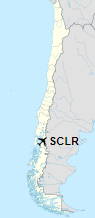
Location of Los Alerces Airport in Chile
|
| Runways |
| Direction |
Length |
Surface |
| m |
ft |
| 09/27 |
502 |
1,647 |
Grass |
|
|
Source: GCM Google Maps |
The above content comes from Wikipedia and is published under free licenses – click here to read more.
The content above was published at Airports-Worldwide.com in 2020.
We don't guarantee the information is fresh and accurate. The data may be wrong or outdated.
For more up-to-date information please refer to other sources.
|


