 |
|
Lontuecito Airport (Spanish: Aeropuerto de Lontuecito), (ICAO: SCUP) is an airstrip serving the Río Claro commune of the Maule Region in Chile. The runway is 1.6 kilometres (1 mi) east of Cumpeo (es), the municipal seat of the commune.
|
Lontuecito Airport |
|
|
| Summary |
| Airport type |
Public |
| Serves |
Río Claro, Chile |
| Elevation AMSL |
1,066 ft / 325 m |
| Coordinates |
35°17′00″S
71°14′12″W |
| Map |
|
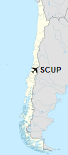
Location of Lontuecito Airport in Chile
|
| Runways |
| Direction |
Length |
Surface |
| m |
ft |
| 03/21 |
980 |
3,215 |
Grass |
|
|
Source: Landings.com Google Maps GCM |
The above content comes from Wikipedia and is published under free licenses – click here to read more.
The content above was published at Airports-Worldwide.com in 2020.
We don't guarantee the information is fresh and accurate. The data may be wrong or outdated.
For more up-to-date information please refer to other sources.
|
|


