Llifen Calcuruppe Airport |
Calcuruppe Airport Spanish: Aeropuerto Calcuruppe,
(ICAO: SCLF) is a lakeside airport 5 kilometres (3.1 mi) south of Llifén, a village in the Los Lagos Region of Chile.
The airport is on the eastern shore of Ranco Lake. There is high terrain north through east of the runway.
|
Calcuruppe Airport |
|
|
| Summary |
| Airport type |
Private |
| Serves |
Llifén, Chile |
| Elevation AMSL |
335 ft / 102 m |
| Coordinates |
40°14′35″S
72°14′54″W |
| Map |
|
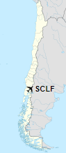
Location of Calcuruppe Airport in Chile
|
| Runways |
| Direction |
Length |
Surface |
| m |
ft |
| 12/30 |
600 |
1,969 |
Grass |
|
|
Source: Landings.com Google Maps GCM |
The above content comes from Wikipedia and is published under free licenses – click here to read more.
The content above was published at Airports-Worldwide.com in 2020.
We don't guarantee the information is fresh and accurate. The data may be wrong or outdated.
For more up-to-date information please refer to other sources.
|


