|
La Chimba Airport (Spanish: Aeropuerto La Chimba, (ICAO: SCMB)) was an airport serving Antofagasta, capital of the Antofagasta Region of Chile.
Google Earth Historical Imagery (10/19/2002) shows the runway marked closed and criss-crossed by new streets. Subsequent imagery show the land filled by a housing project.
|
La Chimba Airport
|
|
|
| Summary |
| Airport type |
Closed |
| Serves |
Antofagasta, Chile |
| Elevation AMSL |
120 ft / 37 m |
| Coordinates |
23°33′13″S
70°23′46″W |
| Map |
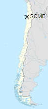
Location of La Chimba Airport in Chile
|
| Runways |
| Direction |
Length |
Surface |
| ft |
m |
| Closed |
|
The above content comes from Wikipedia and is published under free licenses – click here to read more.
| General Info
|
| Country |
Chile
|
| ICAO ID |
SCMB
|
| Time |
UTC-4(-3DT)
|
| Latitude |
-23.553611
23° 33' 13.00" S
|
| Longitude |
-70.396111
070° 23' 46.00" W
|
| Elevation |
131 feet
40 meters
|
| Magnetic Variation |
001° W (01/06)
|
| Operating Agency |
CIVIL GOVERNMENT, (LANDING FEES AND DIPLOMATIC CLEARANCE MAY BE REQUIRED)
|
| Near City |
Antofagasta
|
| Operating Hours |
SUNRISE TO SUNSET (SR-SS)
|
| Runways
|
| ID |
Dimensions |
Surface |
PCN |
ILS
|
| 03/21 |
3281 x 52 feet
1000 x 16 meters |
ASPHALT |
- |
NO
|
| Remarks
|
| CAUTION |
296' rdo ant lctd 1 NM SE of fld. Bird haz.
|
| OPR HOURS |
Opr SR-SS.
|
The content above was published at Airports-Worldwide.com in 2020.
We don't guarantee the information is fresh and accurate. The data may be wrong or outdated.
For more up-to-date information please refer to other sources.
|