|
Quenac Airport (ICAO: SCQE) is an airstrip serving Isla Quenac (es), an island in the Los Lagos Region of Chile.
The island is in the archipelago between the Gulf of Ancud and the Gulf of Corcovado.
The runway is 0.7 kilometres (0.4 mi) south of the shore, and approach and departures to either end will be partially over the water.
The Chaiten VOR-DME (Ident: TEN) is 29.4 nautical miles (54.4 km) southeast of the airstrip.
|
Quenac Airport |
|
|
| Summary |
| Airport type |
Public |
| Serves |
Isla Quenac (es), Chile |
| Elevation AMSL |
164 ft / 50 m |
| Coordinates |
42°27′55″S
73°20′04″W |
| Map |
|
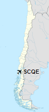
Location of Quenac Airport in Chile
|
| Runways |
| Direction |
Length |
Surface |
| m |
ft |
| 14/32 |
560 |
1,837 |
Grass |
|
|
Source: Landings.com Google Maps GCM |
The above content comes from Wikipedia and is published under free licenses – click here to read more.
The content above was published at Airports-Worldwide.com in 2020.
We don't guarantee the information is fresh and accurate. The data may be wrong or outdated.
For more up-to-date information please refer to other sources.
|


