|
Frutillar Airport (IATA: FRT, ICAO: SCFR) is an airport serving Frutillar, a town at the western end of Llanquihue Lake in the Los Lagos Region of Chile.
The runway lies alongside the Pan-American Highway just to the west of Frutillar, and has an additional 120 metres (390 ft) of grass overrun on the south end.
The Puerto Montt VOR-DME (Ident: MON) is 17.9 nautical miles (33.2 km) south of the airport.
|
Frutillar Airport |
|
|
| Summary |
| Airport type |
Public |
| Serves |
Frutillar, Chile |
| Elevation AMSL |
469 ft / 143 m |
| Coordinates |
41°07′45″S
73°03′52″W |
| Map |
|
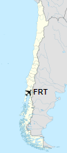
Location of Frutillar Airport in Chile
|
| Runways |
| Direction |
Length |
Surface |
| m |
ft |
| 18/36 |
758 |
2,487 |
Grass |
|
|
Source: Landings.com GCM Google Maps |
The above content comes from Wikipedia and is published under free licenses – click here to read more.
The content above was published at Airports-Worldwide.com in 2020.
We don't guarantee the information is fresh and accurate. The data may be wrong or outdated.
For more up-to-date information please refer to other sources.
|


