|
El Buitre Airport (Spanish: Aeródromo El Buitre, (ICAO: SCAE)) is a military airport just south of Arica,
a Pacific coastal city in the Tarapacá Region of Chile.
The runway is 2 kilometres (1.2 mi) inland from the Pacific shore. There is distant rising terrain southeast of the airport.
The Arica VOR-DME (Ident: ARI) is located 8.9 nautical miles (16.5 km) north-northwest of the airport.
|
El Buitre Airport |
|
|
| Summary |
| Airport type |
Military |
| Serves |
Arica, Chile |
| Elevation AMSL |
328 ft / 100 m |
| Coordinates |
18°30′31″S
70°17′20″W |
| Map |
|
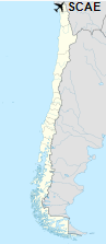
Location of El Buitre Airport in Chile
|
| Runways |
| Direction |
Length |
Surface |
| m |
ft |
| 09/27 |
1,200 |
3,937 |
Asphalt |
|
| Helipads |
| Number |
Length |
Surface |
| m |
ft |
| 1 |
22 |
72 |
Asphalt |
|
|
Source: Landings.com Google Maps GCM |
The above content comes from Wikipedia and is published under free licenses – click here to read more.
The content above was published at Airports-Worldwide.com in 2020.
We don't guarantee the information is fresh and accurate. The data may be wrong or outdated.
For more up-to-date information please refer to other sources.
|


