|
El Amarillo Airport Spanish: Aeropuerto El Amarillo,
(ICAO: SCEA) is an airstrip 21 kilometres (13 mi) east of Chaitén,
a town in the Los Lagos Region of Chile. The Carretera Austral runs through the hamlet of El Amarillo, and passes the south end of the runway.
The airstrip is at the junction of two valleys, one running eastward from Chaitén, and the
other, the valley of the Amarillo River, a glacial fed stream running south from the Chaitén Volcano.
The valleys open up to the southwest, but there is mountainous terrain in all other quadrants.
The runway has an additional 140 metres (460 ft) of unpaved overrun on the south end.
The Chaiten VOR-DME (Ident: TEN) is 20.4 nautical miles (37.8 km) west-northwest of the airstrip.
|
El Amarillo Airport |
|
|
| Summary |
| Airport type |
Private |
| Serves |
Chaitén, Chile |
| Location |
El Amarillo |
| Elevation AMSL |
1,083 ft / 330 m |
| Coordinates |
43°00′25″S
72°28′44″W |
| Map |
|
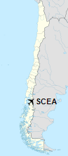
Location of El Amarillo Airport in Chile
|
| Runways |
| Direction |
Length |
Surface |
| m |
ft |
| 01/19 |
492 |
1,614 |
Grass |
|
|
Source: Landings.com Google Maps GCM |
The above content comes from Wikipedia and is published under free licenses – click here to read more.
The content above was published at Airports-Worldwide.com in 2020.
We don't guarantee the information is fresh and accurate. The data may be wrong or outdated.
For more up-to-date information please refer to other sources.
|


