 |
|
Coposa Airport (IATA: CPP, ICAO: SCKP) is an extremely
high elevation airport serving the Pica commune in the Tarapacá Region of Chile.
The airport is 73 kilometres (45 mi) east-southeast of the town of Pica, and 13 kilometres (8.1 mi) west of the Bolivia border.
The Coposa non-directional beacon (Ident: NES) is located 0.6 nautical miles (1.1 km) off the approach threshold of Runway 35.
|
Coposa Airport |
|
|
| Summary |
| Airport type |
Public |
| Serves |
Pica, Chile |
| Elevation AMSL |
12,468 ft / 3,800 m |
| Coordinates |
20°45′00″S
68°41′00″W |
| Map |
|
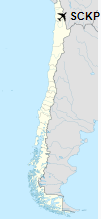
Location of Coposa Airport in Chile
|
| Runways |
| Direction |
Length |
Surface |
| m |
ft |
| 17/35 |
3,200 |
10,499 |
Asphalt |
|
|
Source: Landings.com Google Maps GCM |
The above content comes from Wikipedia and is published under free licenses – click here to read more.
The content above was published at Airports-Worldwide.com in 2020.
We don't guarantee the information is fresh and accurate. The data may be wrong or outdated.
For more up-to-date information please refer to other sources.
|
|


