|
|
Chacalluta International Airport |
Chacalluta International Airport (Aeródromo de Chacalluta Arica) (IATA: ARI, ICAO: SCAR) is an airport serving the city of Arica, capital of the Arica Province in the northern Arica y Parinacota Region of Chile. It is 18.5 kilometres (11.5 mi) northwest of the city and 1 kilometre (0.62 mi) south of the border with Peru.
Runway 02 has an additional 630 metres (2,070 ft) displaced threshold. It is 1.6 kilometres (1 mi) inland from the Pacific shoreline.
The Arica VOR-DME (Ident: ARI) and non-directional beacon (Ident: R) are located on the approach path to Runway 02.
|
Chacalluta International Airport
|
|
|
| Summary |
| Airport type |
Public |
| Serves |
Arica, Arica y Parinacota Region, Chile |
| Elevation AMSL |
m / 166 ft |
| Coordinates |
18°20′55″S
70°20′20″W |
| Maps |
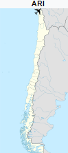
Location of the airport in Chile
|
| Runways |
| Direction |
Length |
Surface |
| m |
ft |
| 02/20 |
2,170 |
7,119 |
Asphalt |
|
irlines and destinations
| Destinations |
| Amaszonas |
Iquique |
| JetSmart |
Concepcion (begins December 16, 2019), La Serena (begins December 18, 2019) |
| LATAM Chile |
Santiago de Chile |
| Sky Airline |
Santiago de Chile |
The above content comes from Wikipedia and is published under free licenses – click here to read more.
| General Info
|
| Country |
Chile
|
| ICAO ID |
SCAR
|
| Time |
UTC-4(-3DT)
|
| Latitude |
-18.348531
18° 20' 54.71" S
|
| Longitude |
-70.338742
070° 20' 19.47" W
|
| Elevation |
167 feet
51 meters
|
| Type |
Civil
|
| Magnetic Variation |
003° W (01/06)
|
| Beacon |
Yes
|
| Operating Agency |
CIVIL GOVERNMENT, (LANDING FEES AND DIPLOMATIC CLEARANCE MAY BE REQUIRED)
|
| Near City |
Arica
|
| Operating Hours |
24 HOUR OPERATIONS
|
| International Clearance Status |
Airport of Entry
|
| Communications
|
| ARICA TWR |
118.5
|
| GND |
121.9
|
| ARICA APP |
119.9
|
| Runways
|
| ID |
Dimensions |
Surface |
PCN |
ILS
|
| 02/20 |
7119 x 148 feet
2170 x 45 meters |
ASPHALT |
040FAXT |
NO
|
| Navaids
|
| Type |
ID |
Name |
Channel |
Freq |
Distance From Field |
Bearing From Navaid
|
| VOR-DME |
ARI |
ARICA |
112X |
116.5 |
1.3 NM |
022.5
|
| NDB |
R |
ARICA |
- |
305 |
1.5 NM |
022.6
|
| Supplies/Equipment
|
| Fuel |
Jet A1, without icing nhibitor.
100/130 MIL Spec, low lead, aviation gasoline (BLUE)
|
| Remarks
|
| CAUTION |
Bird haz. Obst 656' N of thld Rwy 20, elev 203'. Obst 272' N of thld Rwy 20, elev 220'.
|
| CSTMS/IMG |
Avbl 1000-2300Z++/0230-0430Z++Mon-Fri, 1130-2300Z++/0230-0330Z++ Sat-Sun.
|
| FUEL |
Avbl 1100-2300Z++. (NC-100LL, A1)
|
| LGT |
PAPI Rwy 02 GS 2.5 MEHT 56'. For B727 or smaller acft.
|
The content above was published at Airports-Worldwide.com in 2020.
We don't guarantee the information is fresh and accurate. The data may be wrong or outdated.
For more up-to-date information please refer to other sources.
|
|