 |
|
Cerro Paranal Airport (ICAO: SCPA) is a desert airport 6
kilometres (4 mi) east-southeast of Cerro Paranal, Antofagasta, Chile.
It serves the Paranal Observatory and Cerro Armazones Observatory scientific complexes.
There is rising terrain west of the airport.
|
Cerro Paranal Airport |
|
|
| Summary |
| Airport type |
Private |
| Serves |
Cerro Paranal, Chile |
| Elevation AMSL |
6,834 ft / 2,083 m |
| Coordinates |
24°38′20″S
70°20′55″W |
| Map |
|
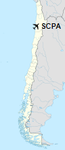
Location of Cerro Paranal Airport in Chile
|
| Runways |
| Direction |
Length |
Surface |
| m |
ft |
| 01/19 |
1,200 |
3,937 |
Gravel |
|
|
Source: Landings.com Google Maps GCM |
The above content comes from Wikipedia and is published under free licenses – click here to read more.
The content above was published at Airports-Worldwide.com in 2020.
We don't guarantee the information is fresh and accurate. The data may be wrong or outdated.
For more up-to-date information please refer to other sources.
|
|


