|
|
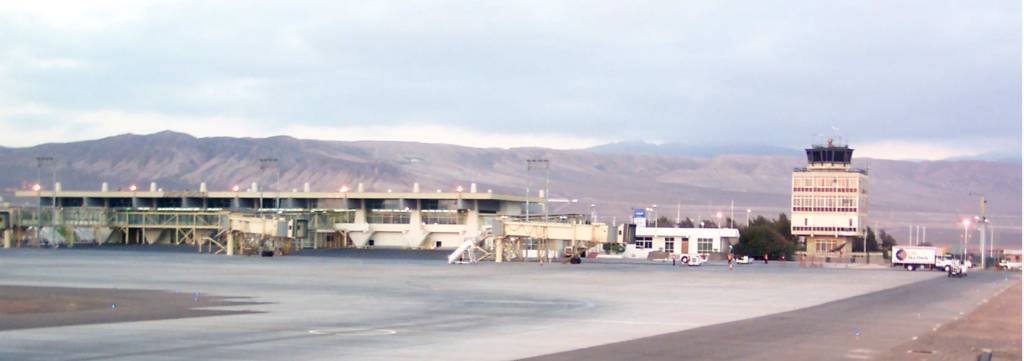
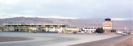
Andrés Sabella Gálvez International Airport |
Andrés Sabella Gálvez International Airport (IATA: ANF, ICAO: SCFA) is an airport serving Antofagasta, capital of the Antofagasta Region of Chile. It is 10 kilometres (6.2 mi) north of Antofagasta and 3 kilometres (1.9 mi) inland from the Pacific coastline.
The Antofagasta VOR-DME (Ident: FAG) and non-directional beacon (Ident: R) are located on the approach path to Runway 01.
|
Andrés Sabella Gálvez International Airport
former Cerro Moreno Intl Airport
|
|
|
| Summary |
| Airport type |
Public |
| Operator |
Sociedad Concesionaria Aeropuerto de Antofagasta S.A. |
| Serves |
Antofagasta, Chile |
| Elevation AMSL |
455 ft / 139 m |
| Coordinates |
23°26′40″S
70°26′42″W |
| Website |
https://www.aeropuertoantofagasta.cl/ |
| Map |
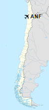
Location of airport in Chile
|
| Runways |
| Direction |
Length |
Surface |
| m |
ft |
| 01/19 |
2,600 |
8,530 |
Asphalt |
|
Airlines and Destinations
| Destinations |
| JetSmart |
Concepción, La Serena, Lima (Begins March 20, 2020), Santiago de Chile |
| LATAM Chile |
Concepción, La Serena, Santiago de Chile |
| LATAM Perú |
Lima |
| Sky Airline |
La Serena, Santiago de Chile |
The above content comes from Wikipedia and is published under free licenses – click here to read more.
| General Info
|
| Country |
Chile
|
| ICAO ID |
SCFA
|
| Time |
UTC-4(-3DT)
|
| Latitude |
-23.444478
23° 26' 40.12" S
|
| Longitude |
-70.445100
070° 26' 42.36" W
|
| Elevation |
455 feet
139 meters
|
| Type |
Joint (Civil and Military)
|
| Magnetic Variation |
001° W (01/06)
|
| Beacon |
Yes
|
| Operating Agency |
MILITARY - CIVIL JOINT USE AIRPORT
|
| Near City |
Antofagasta
|
| Operating Hours |
24 HOUR OPERATIONS
|
| International Clearance Status |
Airport of Entry
|
| Communications
|
| ANTOFAGASTA TWR |
118.1
|
ANTOFAGASTA RDO
(METRO avbl.)
|
127.1
4669
6649
10024
|
| GND |
121.9
|
| ANTOFAGASTA APP |
119.3
120.9
|
| Communications Remarks |
|
| RDO |
FIS will only be provided in upper airspace btn lat S22 0 00.0' and S28 0 30.0' on Antofagasta/Santiago rdo freq 10024.
|
| Runways
|
| ID |
Dimensions |
Surface |
PCN |
ILS
|
| 01/19 |
8527 x 164 feet
2599 x 50 meters |
ASPHALT |
040RAWT |
NO
|
| Navaids
|
| Type |
ID |
Name |
Channel |
Freq |
Distance From Field |
Bearing From Navaid
|
| VOR-DME |
FAG |
ANTOFAGASTA |
096X |
114.9 |
1.4 NM |
007.0
|
| NDB |
R |
ANTOFAGASTA |
- |
305 |
1.5 NM |
007.7
|
| Supplies/Equipment
|
| Fuel |
Jet A1, without icing nhibitor.
100/130 MIL Spec, low lead, aviation gasoline (BLUE)
|
| Remarks
|
| CAUTION |
Obst aprx 6500' fr thld Rwy 19, elev 591'. High Tension Pwr lines aprx 7000' frthld Rwy 19, elev 617'.
|
| CSTMS/AG/IMG |
CSTMS avbl O/R 0800-1718Z++, 2 hr PN. OT user expense.
|
| FUEL |
(NC100LL, A1)
|
| LGT |
PAPI Rwy 01 GS 2.7 ,PAPI Rwy 19 GS 3.7 .
|
The content above was published at Airports-Worldwide.com in 2020.
We don't guarantee the information is fresh and accurate. The data may be wrong or outdated.
For more up-to-date information please refer to other sources.
|
|