|
|
Carlos Ibáñez Del Campo International Airport |
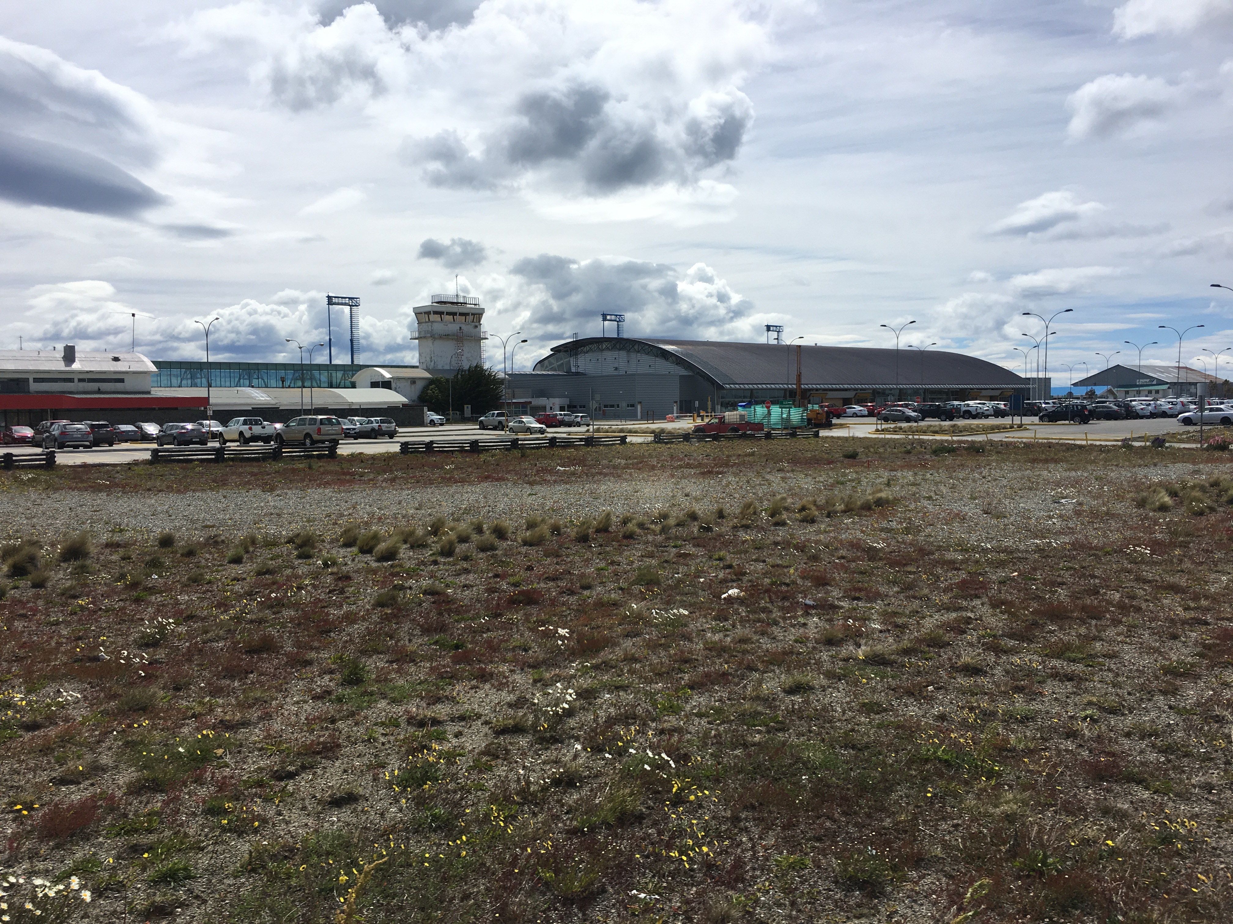
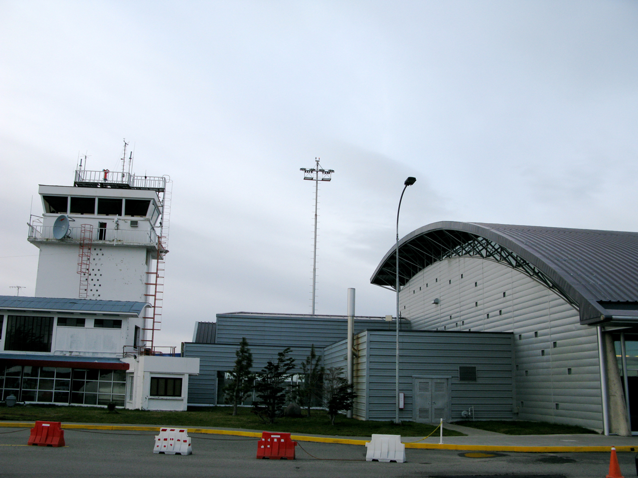
Presidente Carlos Ibáñez International Airport (Spanish: Aeropuerto Internacional Presidente Carlos Ibáñez) (IATA: PUQ, ICAO: SCCI) is an airport serving the city of Punta Arenas in southern Chile in the Patagonia region of South America. The airport is shared with the Chilean Air Force. Its passenger terminal has three departure gates, two luggage belts, and 11 check-in counters.
|
Presidente Carlos Ibáñez International Airport
Aeropuerto Internacional Presidente Carlos Ibáñez
|
|
|
|
| Summary |
| Airport type |
Public / Military |
| Serves |
Punta Arenas, Chile |
| Elevation AMSL |
139 ft / 42 m |
| Coordinates |
53°00′09″S
070°51′16″W |
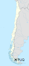
| Map |
Location of airport in Chile
|
| Runways |
| Direction |
Length |
Surface |
| m |
ft |
| 01/19 |
1,678 |
5,504 |
Concrete/Asphalt |
| 07/25 |
2,790 |
9,154 |
Concrete/Asphalt |
| 12/30 |
2,400 |
7,857 |
Concrete/Asphalt |
|
Airlines and destinations
| Destinations |
| Aerovías DAP |
Balmaceda, El Calafate, Porvenir, Puerto Natales, Puerto Williams, Ushuaia
Charter: King George Island |
| JetSmart |
Concepcion, Puerto Montt, Santiago de Chile |
| LATAM Chile |
Concepcion, Puerto Montt, Rio Gallegos, Santiago de Chile, Stanley–Mount Pleasant
Seasonal: Puerto Natales |
| Sky Airline |
Puerto Montt, Santiago de Chile |

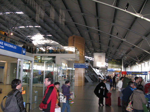
Interior de la terminal del aeropuerto Carlos Ibáñez del Campo.
Emblema de la IV Brigada Aérea de la Fuerza Aérea de Chile.
The above content comes from Wikipedia and is published under free licenses – click here to read more.
| General Info
|
| Country |
Chile
|
| ICAO ID |
SCCI
|
| Time |
UTC-4(-3DT)
|
| Latitude |
-53.002642
53° 00' 09.51" S
|
| Longitude |
-70.854586
070° 51' 16.51" W
|
| Elevation |
139 feet
42 meters
|
| Type |
Joint (Civil and Military)
|
| Magnetic Variation |
014° E (01/06)
|
| Beacon |
Yes
|
| Operating Agency |
MILITARY - CIVIL JOINT USE AIRPORT
|
| Near City |
Punta Arenas
|
| Operating Hours |
24 HOUR OPERATIONS
|
| International Clearance Status |
Airport of Entry
|
| Communications
|
| PUNTA ARENAS TWR |
118.7
|
| PUNTA ARENAS RDO |
6649
10024
|
| GND |
121.9
|
| PUNTA ARENAS APP |
128.1
123.9
|
| Runways
|
| ID |
Dimensions |
Surface |
PCN |
ILS
|
| 01/19 |
5504 x 148 feet
1678 x 45 meters |
PART CONCRETE, PART ASPHALT, OR PART BITUMEN-BOUND MACADAM. |
040RAWT |
NO
|
| 07/25 |
9154 x 148 feet
2790 x 45 meters |
PART CONCRETE, PART ASPHALT, OR PART BITUMEN-BOUND MACADAM. |
040FAWT |
YES
|
| 12/30 |
7875 x 148 feet
2400 x 45 meters |
PART CONCRETE, PART ASPHALT, OR PART BITUMEN-BOUND MACADAM. |
040FAWT |
NO
|
| Navaids
|
| Type |
ID |
Name |
Channel |
Freq |
Distance From Field |
Bearing From Navaid
|
| VOR-DME |
NAS |
PUNTA ARENAS |
088X |
114.1 |
At Field |
-
|
| NDB |
NAS |
PUNTA ARENAS |
- |
270 |
At Field |
-
|
| Supplies/Equipment
|
| Fuel |
Jet A1, without icing nhibitor.
100/130 MIL Spec, low lead, aviation gasoline (BLUE)
|
| Remarks
|
| CAUTION |
Numerous ant lctd in vcnty of fld. Bird haz. Vis fr Twr of first 2461' Rwy 30 obst by bldg. Asphalt layer in poor cond 328' fr thld Rwy 07 to int Rwy 12-30 and entire len Rwy 01-19. Trees 174 ft hgt lctd 1000 ft fr thld Rwy 07.
|
| CSTMS/IMG |
CSTMS-MON-SUN 1145-2218Z++. OT/HOL 0/R PPR WITH 3 HRS BFR FLT. IMG-H24 O/R 3 HRSBFR FLT.
|
| FUEL |
Avbl 0800-1700Z++ Apr-Sep; 0800-2000Z++ Oct-Mar; OT 1 hr PN before end of svc. (NC-100LL, A1)
|
| LGT |
PAPI Rwy 25 GS 2.7 . PAPI Rwy 30 GS 2.7 .
|
The content above was published at Airports-Worldwide.com in 2020.
We don't guarantee the information is fresh and accurate. The data may be wrong or outdated.
For more up-to-date information please refer to other sources.
|
|