|
Enrique Meyer Soto Airport (ICAO: SCCR) is an airport serving Caleta Tortel, a Pacific coastal village in the Aysén Region of Chile.
The runway is on the opposite side of a hill north of the village. There is mountainous terrain in all quadrants.
|
Enrique Mayer Soto Airport
Caleta Tortel Airport |
|
|
| Summary |
| Airport type |
Public |
| Serves |
Caleta Tortel, Chile |
| Elevation AMSL |
4 ft / 1 m |
| Coordinates |
47°47′12″S
73°31′57″W |
| Map |
|
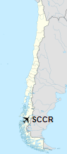
Location of Enrique Mayer Soto Airport in Chile
|
| Runways |
| Direction |
Length |
Surface |
| m |
ft |
| 04/22 |
570 |
1,870 |
Grass |
|
|
Sources: Landings.com Google Maps GCM |
The above content comes from Wikipedia and is published under free licenses – click here to read more.
The content above was published at Airports-Worldwide.com in 2020.
We don't guarantee the information is fresh and accurate. The data may be wrong or outdated.
For more up-to-date information please refer to other sources.
|


