 |
|
Alupenhue Airport (Spanish: Aeropuerto de Alupenhue),
(ICAO: SCXA) is an airport 23 kilometres (14 mi) southeast of Molina, a city in the Maule Region of Chile.
The airport is alongside the Lontué River, 8 kilometres (5.0 mi) upstream from the river's entrance into
the Central Valley. There is mountainous terrain in all quadrants.
|
Alupenhue Airport |
|
|
| Summary |
| Airport type |
Public |
| Serves |
Molina, Chile |
| Elevation AMSL |
1,600 ft / 488 m |
| Coordinates |
35°14′20″S
71°04′15″W |
| Map |
|
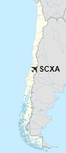
Location of Alupenhue Airport in Chile
|
| Runways |
| Direction |
Length |
Surface |
| m |
ft |
| 14/32 |
707 |
2,320 |
Grass |
|
|
Source: Landings.com Google Maps GCM |
The above content comes from Wikipedia and is published under free licenses – click here to read more.
The content above was published at Airports-Worldwide.com in 2020.
We don't guarantee the information is fresh and accurate. The data may be wrong or outdated.
For more up-to-date information please refer to other sources.
|
|


