 |
|
Agua Santa Airport (Spanish: Aeropuerto Agua Santa), (ICAO: SCAG)
is an airport serving Palmilla, a town in the O'Higgins Region of Chile. The airport is 9 kilometres (5.6 mi) north of Santa Cruz.
There is a mountain ridge less than 1 kilometre (0.62 mi) off the south end of the runway.
|
Agua Santa Airport |
|
|
| Summary |
| Airport type |
Public |
| Location |
Palmilla, Chile |
| Elevation AMSL |
476 ft / 145 m |
| Coordinates |
34°33′05″S
71°20′08″W |
| Map |
|
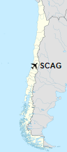
Location of Agua Santa Airport in Chile
|
| Runways |
| Direction |
Length |
Surface |
| m |
ft |
| 18/36 |
1,002 |
3,287 |
Grass |
|
|
Source: Landings.com Google Maps GCM |
The above content comes from Wikipedia and is published under free licenses – click here to read more.
The content above was published at Airports-Worldwide.com in 2020.
We don't guarantee the information is fresh and accurate. The data may be wrong or outdated.
For more up-to-date information please refer to other sources.
|
|


