|
|
| Sao Pedro International Airport |
 |
| IATA: VXE – ICAO: GVSV |
| Summary |
| Airport type |
Public |
| Operator |
Aeroportos Seguranca Aera (ASA) |
| Location |
São Vicente, Cape Verde |
| Elevation AMSL |
66 ft / 20 m |
| Coordinates |
16°49′59″N 25°03′25″W / 16.8331°N 25.0569°W / 16.8331; -25.0569Coordinates: 16°49′59″N 25°03′25″W / 16.8331°N 25.0569°W / 16.8331; -25.0569 |
| Runways |
| Direction |
Length |
Surface |
| ft |
m |
| 07/25 |
6,480 |
1,975 |
Asphalt |
São Pedro International Airport (Portuguese Aeroporto Internacional de São Pedro) (IATA: VXE, ICAO: GVSV) is Cape Verde's third most-used airport located in the island of São Vicente, located nearly 5 kilometres (3.1 mi) from the centre of Mindelo and serves the entire island and the island of Santo Antão. It is located in the valley area of the island and is north of the village of São Pedro. The IATA code prefix represents the second name of the island name and is São V(X)icente, the X is used for letters that are out of use and are taken by other airports in the world. he last two letters of the ICAO code is São Vicente. The airport was inaugurated in 1960. Construction
Work began in 2005 to make São Pedro into an international airport. On December 22nd, 2009 the Sao Pedro Airport became the newest international airport in Cape Verde. This feat will contribute much to well-being of the residents of Sao Vicente as well as Cape Verde islanders as a whole. It has a modern terminal of about 11,000 square meters and has the capacity to process about 500 passengers an hour. The runway, (1,975 meters long), and (45 meters wide) is illuminated.
 | |
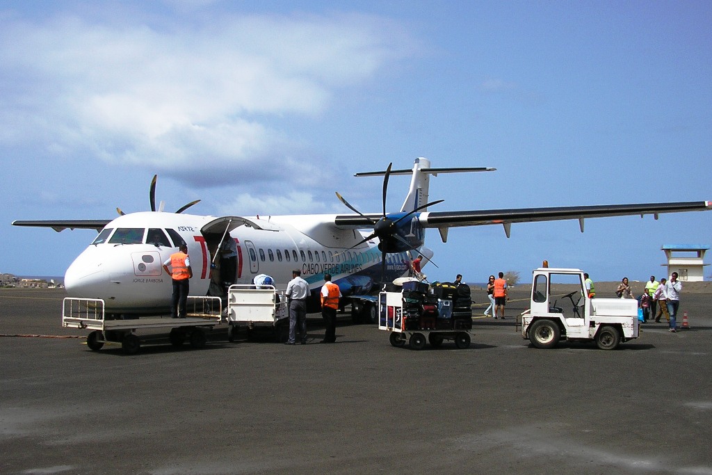
TACV ATR72-500 boarding |
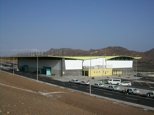 | |
São Pedro Intl Airport new terminal |
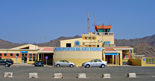 | |
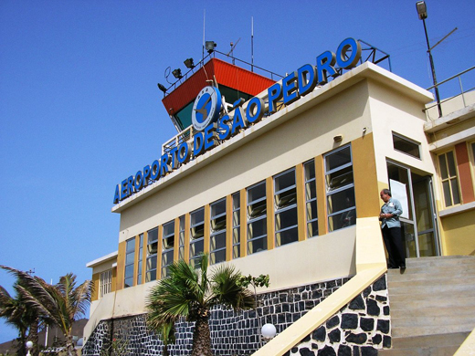
São Pedro Intl Airport old terminal |
Airlines and destinations
| Airlines |
Destinations |
| Cabo Verde Express |
Sal |
| Halcyonair |
Fogo, Praia, Sal |
| TACV |
Fogo, Lisbon, Praia, Sal, São Nicolau |
The above content comes from Wikipedia and is published under free licenses – click here to read more.
| General Info
|
| Country |
Cape Verde
|
| ICAO ID |
GVSV
|
| Time |
UTC-1
|
| Latitude |
16.833689
16° 50' 01.28" N
|
| Longitude |
-25.054661
025° 03' 16.78" W
|
| Elevation |
66 feet
20 meters
|
| Type |
Civil
|
| Magnetic Variation |
011° W (07/06)
|
| Operating Agency |
CIVIL GOVERNMENT, (LANDING FEES AND DIPLOMATIC CLEARANCE MAY BE REQUIRED)
|
| Alternate Name |
SAO VICENTE
|
| Island Group |
Sao Vincente I
|
| Communications
|
| SAO VICENTE TWR |
118.4
|
| SAO VICENTE APP |
118.4
|
| Runways
|
| ID |
Dimensions |
Surface |
PCN |
ILS
|
| 07/25 |
6480 x 148 feet
1975 x 45 meters |
ASPHALT |
- |
NO
|
| Navaids
|
| Type |
ID |
Name |
Channel |
Freq |
Distance From Field |
Bearing From Navaid
|
| NDB |
SVT |
SAO VICENTE |
- |
333 |
At Field |
-
|
| Supplies/Equipment
|
| Fuel |
Jet A, without icing inhibitor.
Jet A1, without icing nhibitor.
|
| Remarks
|
| CSTMS/IMG |
O/R
|
| FUEL |
(NC-A1)
|
| OPR HOURS |
Opr HO.
|
The content above was published at Airports-Worldwide.com in 2010.
We don't guarantee the information is fresh and accurate. The data may be wrong or outdated.
For more up-to-date information please refer to other sources.
|
|