 |
|
Yellowknife Airport (IATA: YZF, ICAO: CYZF) is located in Yellowknife, Northwest Territories, Canada.
The airport is part of the National Airports System, and is operated by the Government of the Northwest Territories.
The airport has regular scheduled passenger service and a number of freight services. In 2007, the terminal handled 527,000 passengers.
In 2008 the airport's passenger terminal underwent an expansion to the departure/check in section, roughly doubling the size of the terminal.
The airport is classified as an airport of entry by Nav Canada and is staffed by the Canada Border Services Agency (CBSA).
CBSA officers at this airport can handle general aviation aircraft only, with no more than 15 passengers.
The Royal Canadian Mounted Police (RCMP) "G" Division maintains a hangar for its air section just south of the passenger terminal.
It is adjacent to a hangar used by the Royal Canadian Air Force (RCAF) to house the CC-138 Twin Otter and other utility aircraft operated by 440
Squadron, a subsidiary of 17 Wing.
Canadian NORAD Region Forward Operating Location Yellowknife is located south-west of the airstrip. It was built for forward deployment of the CF-18 Hornet in times of conflict. It also has a CC-138 permanently based at the airport for search and rescue missions.
|
Yellowknife Airport
Aéroport de Yellowknife |
- IATA: YZF
- ICAO: CYZF
- WMO: 71936
|
| Summary |
| Airport type |
Public |
| Owner/Operator |
Government of the Northwest Territories |
| Location |
Yellowknife, Northwest Territories |
| Hub for |
- Adlair Aviation
- Air Tindi (Discovery Air)
- Buffalo Airways
- Canadian North
- First Air
- Northwestern Air
- North-Wright Airways
- Summit Air
|
| Time zone |
MST (UTC−07:00) |
| • Summer (DST) |
MDT (UTC−06:00) |
| Elevation AMSL |
675 ft / 206 m |
| Coordinates |
62°27′47″N
114°26′25″W |
| Website |
www.dot.gov.nt.ca/Airports/Yellowknife |
| Map |
|
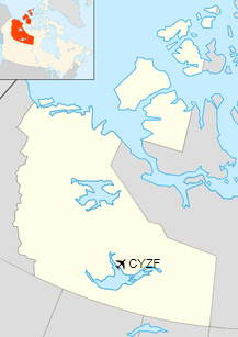
Location in the Northwest Territories
|
| Runways |
| Direction |
Length |
Surface |
| ft |
m |
16/34 |
7,503 |
2,287 |
Asphalt |
10/28 |
5,001 |
1,524 |
Asphalt |
|
| Statistics (2014) |
| Aircraft movements |
52,881 |
|
|
Sources: Canada Flight Supplement
Environment Canada
Movements from Statistics Canada |
Airlines and destinations
Passenger
| Airlines |
Destinations |
| Air Canada Express |
Calgary, Edmonton, Vancouver |
| Air North |
Seasonal: Ottawa, Whitehorse |
| Air Tindi |
Fort Simpson, Lutselk'e, Gamèti, Wekweètì, Whatì |
| Canadian North |
Cambridge Bay, Edmonton, Gjoa Haven, Hope Bay, Inuvik, Iqaluit, Kugaaruk, Kugluktuk, Norman Wells, Ottawa, Rankin Inlet, Taloyoak
Seasonal: Doris Lake
Charter: Vancouver |
| First Air |
Cambridge Bay, Edmonton, Fort Simpson, Gjoa Haven, Hay River, Inuvik, Kugaaruk, Kugluktuk, Taloyoak, Ulukhaktok
Charter: Ekati |
| First Air Operated by Summit Air |
Edmonton, Iqaluit, Rankin Inlet |
| North-Wright Airways |
Déline, Norman Wells, Tulita |
| Nolinor Aviation |
Charter: Mary River |
| Northwestern Air |
Fort Smith |
| WestJet Encore |
Calgary, Edmonton |
Cargo
| Airlines |
Destinations |
| Buffalo Airways |
Cambridge Bay, Déline, Fort Good Hope, Hay River, Kugluktuk, Norman Wells, Tulita |
Emergency services
The airport has its own fire and rescue service. The department has 10 firefighters, but requires only two or three fire fighters on shift to operate a single crash tender. Ambulance and additional fire response is provided by the Yellowknife Fire Department.
Polar bear and seal sculpture, in airport lobby
The above content comes from Wikipedia and is published under free licenses – click here to read more.
| General Info
|
| Country |
Canada
|
| ICAO ID |
CYZF
|
| Latitude |
62.462778
62° 27' 46.00" N
|
| Longitude |
-114.440278
114° 26' 25.00" W
|
| Elevation |
675 feet
206 meters
|
| Type |
Civil
|
| Magnetic Variation |
021° E (01/06)
|
| Beacon |
Yes
|
| Operating Agency |
CIVIL GOVERNMENT, (LANDING FEES AND DIPLOMATIC CLEARANCE MAY BE REQUIRED)
|
| Daylight Saving Time |
Second Sunday in March at 0200 to first Sunday in November at 0200 local time (Exception Arizona and that portion of Indiana in the Eastern Time Zone)
|
| Communications
|
TWR
Opr 1400-0500Z++.
|
118.5
340.8
|
GND
Opr 1400-0500Z++.
|
121.9
|
| RDO |
122.5
126.7
262.0
5680
|
| EDMONTON CNTR |
135.8
|
ATIS
Opr 1400-0500Z++
|
128.4
|
MF
Opr 0500-1400Z++
|
118.5
|
| Runways
|
ID
|
Dimensions |
Surface |
PCN |
ILS
|
| 09/27 |
5000 x 150 feet
1524 x 46 meters |
ASPHALT |
067FAWT |
NO
|
| 15/33 |
7500 x 150 feet
2286 x 46 meters |
ASPHALT |
067FAWT |
NO
|
| Navaids
|
| Type |
ID |
Name |
Channel |
Freq |
Distance From Field |
Bearing From Navaid
|
| VORTAC |
YZF |
YELLOWKNIFE |
102X |
115.5 |
At Field |
-
|
| NDB |
ZF |
YELLOWKNIFE |
- |
356 |
3.1 NM |
334.4
|
| Supplies/Equipment
|
| Fuel |
Jet B, Wide cut turbine fuel, Without icing inhibitor.
Jet A1, without icing nhibitor.
100/130 MIL Spec, low lead, aviation gasoline (BLUE)
|
The content above was published at Airports-Worldwide.com in 2019.
We don't guarantee the information is fresh and accurate. The data may
be wrong or outdated.
For more up-to-date information please refer to other sources.
|
|


