 |
|
Tuktoyaktuk/James Gruben Airport |
Tuktoyaktuk/James Gruben Airport (IATA: YUB, ICAO: CYUB) is near Tuktoyaktuk, Northwest Territories, Canada.
The airport is classified as an airport of entry by Nav Canada and is staffed by the Canada Border Services Agency (CBSA).
CBSA officers at this airport can handle general aviation aircraft only, with no more than 15 passengers.
There are regular flights going and arriving into the airport, but they come almost entirely from Inuvik.
|
Tuktoyaktuk/James Gruben Airport. |
The airport is named for James Gruben a local bush pilot/businessman who was killed on the ice road from Inuvik to Tuktoyaktuk on 13 April 2001.
He was the owner of the only 100% Inuvialuit-owned transportation company, E. Gruben's Transport Ltd., that was passed down to him from his father Eddie Gruben
and is still in business to this day.
|
Tuktoyaktuk/James Gruben Airport |
- IATA: YUB
- ICAO: CYUB
- WMO: 71985
|
| Summary |
| Airport type |
Public |
| Operator |
Government of the Northwest Territories |
| Location |
Tuktoyaktuk, Northwest Territories |
| Time zone |
MST (UTC−07:00) |
| • Summer (DST) |
MDT (UTC−06:00) |
| Elevation AMSL |
14 ft / 4 m |
| Coordinates |
69°26′00″N
133°01′35″W |
| Map |
|
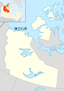
Location in the Northwest Territories
|
| Runways |
| Direction |
Length |
Surface |
| ft |
m |
10/28 |
4,600 |
1,402 |
Gravel |
|
| Statistics (2010) |
|
|
|
Sources: Canada Flight Supplement
Environment Canada
Movements from Statistics Canada. |
Airlines and destinations
| Airlines |
Destinations |
| Kenn Borek Air operating as
Aklak Air |
Inuvik |
The above content comes from Wikipedia and is published under free licenses – click here to read more.
| General Info
|
| Country |
Canada
|
| ICAO ID |
CYUB
|
| Latitude |
69.433334
69° 26' 00.00" N
|
| Longitude |
-133.026389
133° 01' 35.00" W
|
| Elevation |
15 feet
5 meters
|
| Magnetic Variation |
029° E (01/06)
|
| Beacon |
Yes
|
| Operating Agency |
CIVIL GOVERNMENT, (LANDING FEES AND DIPLOMATIC CLEARANCE MAY BE REQUIRED)
|
| Alternate Name |
BAR 3
|
| Daylight Saving Time |
Second Sunday in March at 0200 to first Sunday in November at 0200 local time (Exception Arizona and that portion of Indiana in the Eastern Time Zone)
|
| Communications
|
TUK RDO
Opr 1400-0600Z++, O/T USED AS CTAF.
|
122.1
|
MANDATORY FREQ
Opr 0600-1400Z++.
|
122.1
|
| Runways
|
ID
|
Dimensions |
Surface |
PCN |
ILS
|
| 09/27 |
5000 x 150 feet
1524 x 46 meters |
GRAVEL. |
014FDZU |
NO
|
| Navaids
|
| Type |
ID |
Name |
Channel |
Freq |
Distance From Field |
Bearing From Navaid
|
| NDB |
YUB |
TUKTOYAKTUK |
- |
380 |
At Field |
-
|
The content above was published at Airports-Worldwide.com in 2019.
We don't guarantee the information is fresh and accurate. The data may
be wrong or outdated.
For more up-to-date information please refer to other sources.
|
|


