 |
|
Norman Wells Airport (IATA: YVQ, ICAO: CYVQ) is located adjacent to Norman Wells, Northwest Territories, Canada. North-Wright Airways has its hangar and office adjacent to the airport.
|
Norman Wells Airport |
- IATA: YVQ
- ICAO: CYVQ
- WMO: 71043
|
| Summary |
| Airport type |
Public |
| Operator |
Government of the Northwest Territories |
| Location |
Norman Wells, Northwest Territories |
| Hub for |
North-Wright Airways |
| Time zone |
MST (UTC−07:00) |
| • Summer (DST) |
MDT (UTC−06:00) |
| Elevation AMSL |
237 ft / 72 m |
| Coordinates |
65°16′53″N
126°47′55″W |
| Map |
|
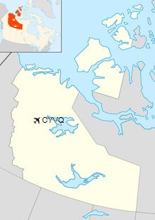
Location in the Northwest Territories
|
| Runways |
| Direction |
Length |
Surface |
| ft |
m |
10/28 |
5,998 |
1,828 |
Asphalt |
|
| Statistics (2010) |
| Aircraft movements |
13,885 |
|
|
Sources: Canada Flight Supplement
Environment Canada
Movements from Statistics Canada |
Airlines and destinations
| Airlines |
Destinations |
| Canadian North |
Edmonton, Inuvik, Yellowknife |
| Discovery Air |
Calgary |
| North-Wright Airways |
Deline, Fort Good Hope, Inuvik, Tulita, Yellowknife, Colville Lake |
Cargo
| Airlines |
Destinations |
| Buffalo Airways |
Yellowknife |
Accidents and incidents
On 5 January 1972, Douglas C-47B CF-KAH of Mackenzie Air was damaged beyond economic repair at Norman Wells Airport.
The above content comes from Wikipedia and is published under free licenses – click here to read more.
| General Info
|
| Country |
Canada
|
| ICAO ID |
CYVQ
|
| Latitude |
65.281617
65° 16' 53.82" N
|
| Longitude |
-126.798219
126° 47' 53.59" W
|
| Elevation |
238 feet
73 meters
|
| Magnetic Variation |
027° E (01/06)
|
| Beacon |
Yes
|
| Operating Agency |
CIVIL GOVERNMENT, (LANDING FEES AND DIPLOMATIC CLEARANCE MAY BE REQUIRED)
|
| Daylight Saving Time |
Second Sunday in March at 0200 to first Sunday in November at 0200 local time (Exception Arizona and that portion of Indiana in the Eastern Time Zone)
|
| Communications
|
| NORMAN WELLS RDO |
122.2
126.7
282.3
|
| MF |
122.2
|
| EDMONTON CNTR |
134.825
|
| Communications Remarks |
|
| A/D |
C867-587-2555.
|
| Runways
|
ID
|
Dimensions |
Surface |
PCN |
ILS
|
| 09/27 |
5997 x 150 feet
1828 x 46 meters |
ASPHALT |
067FDXT |
NO
|
| Navaids
|
| Type |
ID |
Name |
Channel |
Freq |
Distance From Field |
Bearing From Navaid
|
| VOR-DME |
YVQ |
NORMAN WELLS |
074X |
112.7 |
2.1 NM |
271.8
|
| NDB |
VQ |
NORMAN WELLS |
- |
326 |
3.7 NM |
269.4
|
| Supplies/Equipment
|
| Fuel |
Jet B, Wide cut turbine fuel, Without icing inhibitor.
100/130 octane gasoline, leaded, MIL-L-5572F (GREEN)
|
The content above was published at Airports-Worldwide.com in 2019.
We don't guarantee the information is fresh and accurate. The data may
be wrong or outdated.
For more up-to-date information please refer to other sources.
|
|


