 |
|
Hay River/Merlyn Carter Airport |
Hay River/Merlyn Carter Airport (IATA: YHY, ICAO: CYHY) is located 1.5 nautical miles (2.8 km; 1.7 mi) north of Hay River, Northwest Territories, Canada. Sandhill cranes may be found nesting on the airport from May until September. The airport is named for former bush pilot Merlyn Carter who was killed by a black bear in 2005.
|
Hay River/Merlyn Carter Airport. |
|
Hay River/Merlyn Carter Airport |
- IATA: YHY
- ICAO: CYHY
- WMO: 71935
|
| Summary |
| Airport type |
Public |
| Operator |
Government of the Northwest Territories |
| Location |
Hay River, Northwest Territories |
| Time zone |
MST (UTC−07:00) |
| • Summer (DST) |
MDT (UTC−06:00) |
| Elevation AMSL |
541 ft / 165 m |
| Coordinates |
60°50′23″N
115°46′58″W |
| Map |
|
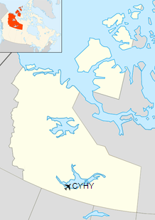
Location in the Northwest Territories
|
| Runways |
| Direction |
Length |
Surface |
| ft |
m |
14/32 |
6,000 |
1,829 |
Asphalt |
04/22 |
4,001 |
1,220 |
Gravel/Asphalt |
|
| Statistics (2010) |
|
|
|
Sources: Canada Flight Supplement
Environment Canada
Movements from Statistics Canada. |
|
Hay River/Merlyn Carter Airport. |
Hay River Airport sign
Airlines and destinations
| Airlines |
Destinations |
| First Air |
Yellowknife |
| Northwestern Air |
Edmonton, Fort Smith, High Level |
|
Hay River/Merlyn Carter Airport. |
Cargo
| Airlines |
Destinations |
| Buffalo Airways |
Yellowknife |
|
Hay River/Merlyn Carter Airport. |
|
Hay River/Merlyn Carter Airport. |
|
Hay River/Merlyn Carter Airport. |
The above content comes from Wikipedia and is published under free licenses – click here to read more.
| General Info
|
| Country |
Canada
|
| ICAO ID |
CYHY
|
| Latitude |
60.839722
60° 50' 23.00" N
|
| Longitude |
-115.782778
115° 46' 58.00" W
|
| Elevation |
543 feet
166 meters
|
| Type |
Civil
|
| Magnetic Variation |
021° E (01/06)
|
| Beacon |
Yes
|
| Operating Agency |
CIVIL GOVERNMENT, (LANDING FEES AND DIPLOMATIC CLEARANCE MAY BE REQUIRED)
|
| Daylight Saving Time |
Second Sunday in March at 0200 to first Sunday in November at 0200 local time (Exception Arizona and that portion of Indiana in the Eastern Time Zone)
|
| Communications
|
| MANDATORY FREQ |
122.3
|
| EDMONTON CNTR |
133.85
|
| YELLOWKNIFE RDO |
126.7
296.2
|
| Communications Remarks |
|
| A/D |
(Yellowknife RCO)
|
| Runways
|
ID
|
Dimensions |
Surface |
PCN |
ILS
|
| 04/22 |
4000 x 150 feet
1219 x 46 meters |
COMPOSITE, LESS THAN 50 PERCENT OF THE RUNWAY LENGTH IS PERMANENT. |
- |
NO
|
| 13/31 |
6000 x 150 feet
1829 x 46 meters |
ASPHALT |
051FDXT |
NO
|
| Navaids
|
| Type |
ID |
Name |
Channel |
Freq |
Distance From Field |
Bearing From Navaid
|
| VOR-DME |
YHY |
HAY RIVER |
086X |
113.9 |
At Field |
-
|
The content above was published at Airports-Worldwide.com in 2019.
We don't guarantee the information is fresh and accurate. The data may
be wrong or outdated.
For more up-to-date information please refer to other sources.
|
|


