 |
|
Fort Simpson Airport (IATA: YFS, ICAO: CYFS) is located 7.4 nautical miles (13.7 km; 8.5 mi) east southeast of Fort Simpson, Northwest Territories, Canada.
|
Fort Simpson Airport |
- IATA: YFS
- ICAO: CYFS
- WMO: 71946
|
| Summary |
| Operator |
Government of the Northwest Territories |
| Location |
Fort Simpson, Northwest Territories |
| Time zone |
MST (UTC−07:00) |
| • Summer (DST) |
MDT (UTC−06:00) |
| Elevation AMSL |
556 ft / 169 m |
| Coordinates |
61°45′37″N
121°14′12″W |
| Map |
|
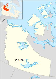
Location in the Northwest Territories
|
| >Runways |
| Direction |
Length |
Surface |
| ft |
m |
14/32 |
6,000 |
1,829 |
Asphalt |
|
| Statistics (2010) |
|
|
|
Sources: Canada Flight Supplement
Environment Canada
Movements from Statistics Canada. |
Airlines and destinations
| Airlines |
Destinations |
| Air Tindi |
Yellowknife |
| First Air |
Yellowknife |
Accidents and incidents
- On 26 June 1994, Douglas C-47A C-FROD of Buffalo Airways crashed on
approach due to fuel exhaustion. The aircraft was on a cargo flight from Trout Lake Airport.
There were two crews on board at that time. There were no fatalities but the aircraft was written off.
The above content comes from Wikipedia and is published under free licenses – click here to read more.
| General Info
|
| Country |
Canada
|
| ICAO ID |
CYFS
|
| Latitude |
61.760153
61° 45' 36.55" N
|
| Longitude |
-121.236525
121° 14' 11.49" W
|
| Elevation |
555 feet
169 meters
|
| Magnetic Variation |
023° E (07/06)
|
| Beacon |
Yes
|
| Operating Agency |
CIVIL GOVERNMENT, (LANDING FEES AND DIPLOMATIC CLEARANCE MAY BE REQUIRED)
|
| Daylight Saving Time |
Second Sunday in March at 0200 to first Sunday in November at 0200 local time (Exception Arizona and that portion of Indiana in the Eastern Time Zone)
|
| Communications
|
| FT SIMPSON RDO |
122.2
|
| YELLOWKNIFE RDO |
126.7
296.6
|
| EDMONTON CNTR |
135.4
|
| Runways
|
ID
|
Dimensions |
Surface |
PCN |
ILS
|
| 13/31 |
6000 x 150 feet
1829 x 46 meters |
ASPHALT |
051FDXT |
NO
|
| Navaids
|
| Type |
ID |
Name |
Channel |
Freq |
Distance From Field |
Bearing From Navaid
|
| VOR-DME |
YFS |
FORT SIMPSON |
126X |
117.9 |
2.0 NM |
091.2
|
| NDB |
FS |
FORT SIMPSON |
- |
375 |
1.7 NM |
132.3
|
| Supplies/Equipment
|
| Fuel |
Jet B, Wide cut turbine fuel, Without icing inhibitor.
100/130 octane gasoline, leaded, MIL-L-5572F (GREEN)
|
The content above was published at Airports-Worldwide.com in 2019.
We don't guarantee the information is fresh and accurate. The data may
be wrong or outdated.
For more up-to-date information please refer to other sources.
|
|


