 |
|
Fort Resolution Airport (IATA: YFR, ICAO: CYFR) is located adjacent to Fort Resolution, Northwest Territories, Canada.
|
Fort Resolution Airport |
|
|
| Summary |
| Airport type |
Public |
| Operator |
Government of the Northwest Territories |
| Location |
Fort Resolution, Northwest Territories |
| Time zone |
MST (UTC−07:00) |
| • Summer (DST) |
MDT (UTC−06:00) |
| Elevation AMSL |
527 ft / 161 m |
| Coordinates |
61°10′51″N
113°41′23″W |
| Map |
|
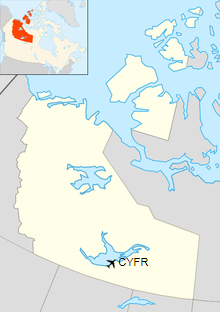
Location in the Northwest Territories
|
| Runways |
| Direction |
Length |
Surface |
| ft |
m |
13/31 |
4,001 |
1,220 |
Gravel |
|
| Statistics (2010) |
|
|
|
Source: Canada Flight Supplement
Movements from Statistics Canada. |
The above content comes from Wikipedia and is published under free licenses – click here to read more.
| General Info
|
| Country |
Canada
|
| ICAO ID |
CYFR
|
| Latitude |
61.180832
61° 10' 51.00" N
|
| Longitude |
-113.689722
113° 41' 23.00" W
|
| Elevation |
526 feet
160 meters
|
| Magnetic Variation |
020° E (01/06)
|
| Operating Agency |
CIVIL GOVERNMENT, (LANDING FEES AND DIPLOMATIC CLEARANCE MAY BE REQUIRED)
|
| Daylight Saving Time |
Second Sunday in March at 0200 to first Sunday in November at 0200 local time (Exception Arizona and that portion of Indiana in the Eastern Time Zone)
|
| Communications
|
ARPT RDO
MON-FRI, 1500-2300Z++. CLOSED SAT, SUN, HOL. O/T USED AS CTAF.
|
122.1
|
| MANDATORY FREQ |
122.1
|
| Communications Remarks |
|
| RDO |
when airport unattended use 122.1 as ctaf.
|
| Runways
|
ID
|
Dimensions |
Surface |
PCN |
ILS
|
| 12/30 |
4000 x 100 feet
1219 x 30 meters |
GRAVEL. |
004FDZU |
NO
|
| Navaids
|
| Type |
ID |
Name |
Channel |
Freq |
Distance From Field |
Bearing From Navaid
|
| NDB |
FR |
FORT RESOLUTION |
- |
274 |
2.2 NM |
295.9
|
The content above was published at Airports-Worldwide.com in 2019.
We don't guarantee the information is fresh and accurate. The data may
be wrong or outdated.
For more up-to-date information please refer to other sources.
|
|


