 |
|
Fort Good Hope Airport (IATA: YGH, ICAO: CYGH) is located 1 nautical mile (1.9 km; 1.2 mi) southwest of Fort Good Hope, Northwest Territories, Canada.
|
Fort Good Hope Airport |
- IATA: YGH
- ICAO: CYGH
- WMO: 71491
|
| Summary |
| Airport type |
Public |
| Operator |
Government of the Northwest Territories |
| Location |
Fort Good Hope, Northwest Territories |
| Time zone |
MST (UTC−07:00) |
| • Summer (DST) |
MDT (UTC−06:00) |
| Elevation AMSL |
267 ft / 81 m |
| Coordinates |
66°14′26″N
128°38′51″W |
| Map |
|
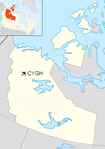
Location in the Northwest Territories
|
| Runways |
| Direction |
Length |
Surface |
| ft |
m |
07/25 |
4,434 |
1,351 |
Gravel |
|
| Statistics (2010) |
|
|
|
Sources: Canada Flight Supplement
Environment Canada
Movements from Statistics Canada. |
Airlines and destinations
| Airlines |
Destinations |
| North-Wright Airways |
Inuvik, Norman Wells, on demand service: Colville Lake |
Cargo
| Airlines |
Destinations |
| Buffalo Airways |
Yellowknife |
The above content comes from Wikipedia and is published under free licenses – click here to read more.
| General Info
|
| Country |
Canada
|
| ICAO ID |
CYGH
|
| Latitude |
66.240833
66° 14' 27.00" N
|
| Longitude |
-128.650833
128° 39' 03.00" W
|
| Elevation |
268 feet
82 meters
|
| Magnetic Variation |
027° E (01/06)
|
| Operating Agency |
CIVIL GOVERNMENT, (LANDING FEES AND DIPLOMATIC CLEARANCE MAY BE REQUIRED)
|
| Daylight Saving Time |
Second Sunday in March at 0200 to first Sunday in November at 0200 local time (Exception Arizona and that portion of Indiana in the Eastern Time Zone)
|
| Communications
|
AIRPORT RDO
1400-2400Z++, NON-SAT. 1400-1900Z++, SUN. O/T USED FOR CTAF.
|
122.1
|
| NORMAN WELLS RDO |
126.7
|
| MANDATORY FREQ |
122.1
|
| Communications Remarks |
|
| FSS |
(NORMAN WELLS RCO)
|
| Runways
|
ID
|
Dimensions |
Surface |
PCN |
ILS
|
| 06/24 |
3000 x 98 feet
914 x 30 meters |
GRAVEL. |
- |
NO
|
| Navaids
|
| Type |
ID |
Name |
Channel |
Freq |
Distance From Field |
Bearing From Navaid
|
| VOR-DME |
YGH |
FORT GOOD HOPE |
070X |
112.3 |
At Field |
-
|
| NDB |
GH |
FORT GOOD HOPE |
- |
266 |
1.5 NM |
179.1
|
The content above was published at Airports-Worldwide.com in 2019.
We don't guarantee the information is fresh and accurate. The data may
be wrong or outdated.
For more up-to-date information please refer to other sources.
|
|


