 |
|
Aklavik/Freddie Carmichael Airport |
Aklavik/Freddie Carmichael Airport (IATA: LAK, ICAO: CYKD) is located adjacent to Aklavik, Northwest Territories, Canada.
The aerodrome is built on the banks of the Peel Channel of the Mackenzie River delta. Aklavik was the regional centre but was prone to flooding.
In 1959, Inuvik was purposely built to house a larger airport, highway connections, new health facilities, housing and an innovative public utilidoor system.
Aklavik remains a small traditional village that retains its connections to the land and river.
|
Aklavik/Freddie Carmichael Airport |
|
|
| Summary |
| Airport type |
Public |
| Operator |
Government of the Northwest Territories |
| Location |
Aklavik, NT |
| Time zone |
MST (UTC−07:00) |
| • Summer (DST) |
MDT (UTC−06:00) |
| Elevation AMSL |
21 ft / 6 m |
| Coordinates |
68°13′24″N
135°00′20″W |
| Map |
|
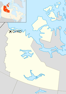
Location in the Northwest Territories
|
| Runways |
| Direction |
Length |
Surface |
| ft |
m |
13/31 |
3,002 |
915 |
Gravel |
|
| Statistics (2009) |
|
|
|
Source: Canada Flight Supplement
Movements from Statistics Canada |
Airlines and destinations
| Airlines |
Destinations |
| North-Wright Airways |
Seasonal: Inuvik |
The above content comes from Wikipedia and is published under free licenses – click here to read more.
| General Info
|
| Country |
Canada
|
| ICAO ID |
CYKD
|
| Latitude |
68.223333
68° 13' 24.00" N
|
| Longitude |
-135.005833
135° 00' 21.00" W
|
| Elevation |
23 feet
7 meters
|
| Magnetic Variation |
028° E (01/06)
|
| Beacon |
Yes
|
| Operating Agency |
CIVIL GOVERNMENT, (LANDING FEES AND DIPLOMATIC CLEARANCE MAY BE REQUIRED)
|
| Daylight Saving Time |
Second Sunday in March at 0200 to first Sunday in November at 0200 local time (Exception Arizona and that portion of Indiana in the Eastern Time Zone)
|
| Communications
|
ARPT RDO
Opr 1400-2400Z++ Mon-Sat,1500-2000Z++ Sun, exc hol.
|
122.1
|
| CTAF |
122.1
|
| Runways
|
ID
|
Dimensions |
Surface |
PCN |
ILS
|
| 13/31 |
3000 x 75 feet
914 x 23 meters |
GRAVEL. |
- |
NO
|
| Navaids
|
| Type |
ID |
Name |
Channel |
Freq |
Distance From Field |
Bearing From Navaid
|
| NDB |
YKD |
AKLAVIK |
- |
208 |
At Field |
-
|
The content above was published at Airports-Worldwide.com in 2019.
We don't guarantee the information is fresh and accurate. The data may
be wrong or outdated.
For more up-to-date information please refer to other sources.
|
|


