 |
|
Kindersley Regional Airport |
Kindersley Regional Airport, (IATA: YKY, ICAO: CYKY), is located 2.5 nautical miles (4.6 km; 2.9 mi) north of Kindersley, Saskatchewan, Canada.
|
Kindersley Regional Airport |
- IATA: YKY
- ICAO: CYKY
- WMO: 71129
|
| Summary |
| Airport type |
Public |
| Operator |
Town of Kindersley |
| Location |
Kindersley No. 290, near Kindersley, Saskatchewan |
| Time zone |
CST (UTC−06:00) |
| Elevation AMSL |
2,276 ft / 694 m |
| Coordinates |
51°30′55″N
109°10′50″W |
| Map |
|
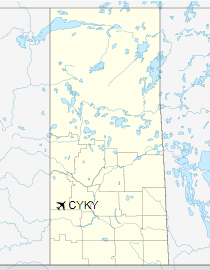
Location in Saskatchewan
|
| Runways |
| Direction |
Length |
Surface |
| ft |
m |
08/26 |
3,507 |
1,069 |
Asphalt |
17/35 |
2,281 |
695 |
Turf |
|
|
Source: Canada Flight Supplement
Environment Canada |
The above content comes from Wikipedia and is published under free licenses – click here to read more.
| General Info
|
| Country |
Canada
|
| ICAO ID |
CYKY
|
| Latitude |
51.517500
51° 31' 03.00" N
|
| Longitude |
-109.180833
109° 10' 51.00" W
|
| Elevation |
2277 feet
694 meters
|
| Magnetic Variation |
013° E (01/06)
|
| Beacon |
Yes
|
| Operating Agency |
MUNICIPAL
|
| Communications
|
| CTAF |
122.8
|
| Runways
|
ID
|
Dimensions |
Surface |
PCN |
ILS
|
| 07/25 |
3507 x 75 feet
1069 x 23 meters |
ASPHALT |
- |
NO
|
| 17/35 |
2281 x 100 feet
695 x 30 meters |
GRASS OR EARTH NOT GRADED OR ROLLED. |
- |
NO
|
| Navaids
|
| Type |
ID |
Name |
Channel |
Freq |
Distance From Field |
Bearing From Navaid
|
| NDB |
M3 |
KINDERSLEY |
- |
402 |
At Field |
-
|
| Supplies/Equipment
|
| Fuel |
100/130 MIL Spec, low lead, aviation gasoline (BLUE)
|
The content above was published at Airports-Worldwide.com in 2019.
We don't guarantee the information is fresh and accurate. The data may
be wrong or outdated.
For more up-to-date information please refer to other sources.
|
|


